
Urban-Rural divide: Residents identify significant concern with environmental policy in Caledon’s new Official Plan
Modern day Caledon is where a struggle constantly unfolds between the protection of vast rural spaces and accommodation of the bursting GTA population that surrounds it.
Caledon Village was settled in the 1820s as a midpoint on the journey from Toronto to Owen Sound. Built around the railway, the town became a hub with three hotels, three blacksmiths, a doctor, a tailor, two shoemakers, two churches, a common school, the Orange Lodge, four driving sheds, three general stores and a population of 350.
The original Caledon Village diminished as travel became faster without the need to rest as often. But other areas of the expansive municipality have grown rapidly.
Bolton, the largest village, started as a farming community, before turning to other industries with the establishment of a large flour mill. Just over 50 years ago the mill closed, and with the emergence of surrounding transportation corridors, the population began to grow.
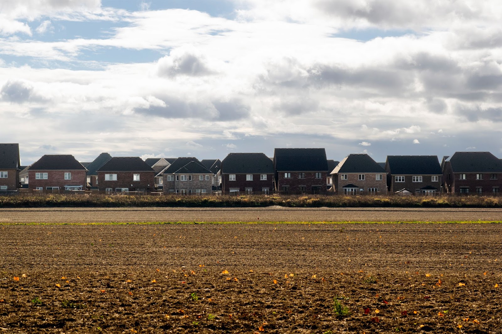
Since the consolidation of the current Official Plan in 2018, the population of the Town of Caledon has increased approximately 15 percent, with most of the growth in the urban areas of Bolton, Caledon East and Mayfield West. These three communities look much more like Brampton or Mississauga than the more rural areas of Caledon where homes dot multi-acre lots.
With looming population pressure across the GTA, Caledon is projected to grow more rapidly over the next two decades. The PC government’s Bill 23 set the target for the municipality to accommodate 13,000 new homes by 2031.
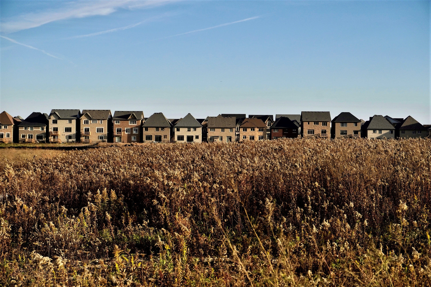
Caledon’s Mayfield West community is rapidly growing with population pushing outward from Brampton.
(Alexis Wright/The Pointer)
These are the realities around the Official Plan update the municipality has undertaken. The Planning Act requires OPs to be reviewed every five years, and changes to the Places to Grow Act and Growth Plan for the Greater Golden Horseshoe have mandated that municipalities plan for growth up until 2051.
At a public meeting, held in accordance with the Planning Act, last week, many residents brought forth the idea of having two separate visions under the Plan, one for the urban areas and one for the rural areas. The idea comes as the three designated urban areas continue to experience rapid growth, while many living in Caledon’s rural areas want protections for the key agricultural and ecological lands that surround them.
“I've conceded south of King Road is going to be developed. They want their development. They want to make it easy for people, but then it should be split into urban and rural areas,” Cheryl Connors, a resident of Caledon who ran for a seat on council in the 2022 municipal election, told The Pointer.
In transitioning policies for the coming urban growth, residents expressed concern that environmental and natural heritage policies designed to protect rural areas are being significantly weakened.
"I don't think that level of abandonment is appropriate in the rural area," Jane Thompson, a resident of Caledon and an environmental lawyer with over 30 years of experience, said to council.
Caledon is a hotspot for future development, the empty fields of green attractive to developers looking to push the urban boundaries of Peel Region and spill over into vast acreage. Based on the decisions of the current and former council, it is clear some are proponents of this vision, despite Mayor Annette Groves’ constant reassurance that she will protect the integrity of Caledon’s natural heritage.
“We want Caledon to remain what Caledon really is,” she previously told The Pointer. “We want to make sure that Caledon remains a place where we continue to enjoy the great outdoors and the quality of life we've come to enjoy so much here.”
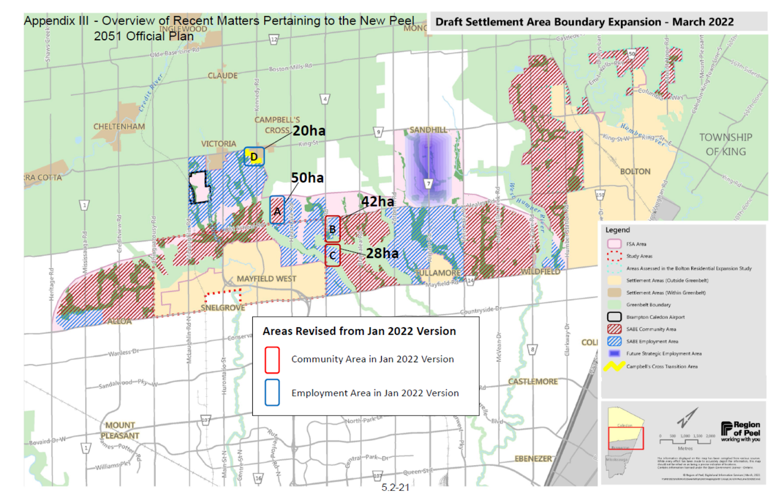
Land within the expanded urban boundary was designated as employment or residential.
(Region of Peel)
In April 2022, Groves — then sitting as a regional councillor — was the only one to vote against an 11,000 acre urban boundary expansion proposed to accommodate growth in the region to 2051. Following the decision, the Ontario government handed down a slightly different plan with 44 modifications to the Regional plan. After backtracking on its decision to manipulate urban growth, the province gave municipalities the opportunity to provide input on how they would like to see their urban boundaries evolve. While the Region of Peel voted to return to the original plan without the province’s 44 modifications, the Town of Caledon requested some of the modifications remain in place, a wish that was granted.
But the PC government has its sights set on Caledon. While repeated studies — including one completed by the province’s own Housing Task Force — have concluded there is more than enough land within existing urban boundaries to build two million homes across Ontario, surpassing the province’s goal of 1.5 million by 2031, Premier Doug Ford and his Housing Minister continue to push policy that makes it easier to build sprawling development, overflowing urban boundaries.
Caledon is the last vast tract of undeveloped expanse, much of it within a 40-minute drive of Toronto’s city centre.
Since first taking power in 2018, the PC government has triggered a major push for warehouse developments in the southern reaches of the Greenbelt, many of them connected to the proposed Highway 413 route. Since 2020, the PCs have issued four MZOs for the Town, a tool that bypasses local decision making around land use and planning.
Highway 413 stands to dramatically alter the look and feel of Caledon while tearing through valuable greenspace. Forty-five percent of the proposed 52-kilometre route cuts right through south Caledon, between Mayfield Road and King Street, unearthing over 2,000 acres of prime farmland, cutting across rivers and streams 85 times and intersecting the habitat of 29 species at risk.
While the PC government has touted the highway as a time saver and a much needed development to alleviate traffic congestion on the 401, repeated studies by opposition parties and environmental groups have shown that the highway would save commuters approximately 1 minute and instead would unlock valuable land to continue to build car dependent, sprawling communities.
Caledon — alongside Brampton — is one of the only communities along the proposed route that has not passed a motion in opposition to the highway. In February 2022, Groves brought forward a motion, asking the town to declare an opposition position, but was defeated.
In the new draft OP, Caledon speaks of the 413 like it is a done deal.
"The Town will encourage the Province to undertake highway improvements in a timely fashion, particularly the implementation of the Highway 413 Transportation Corridor," the draft reads.
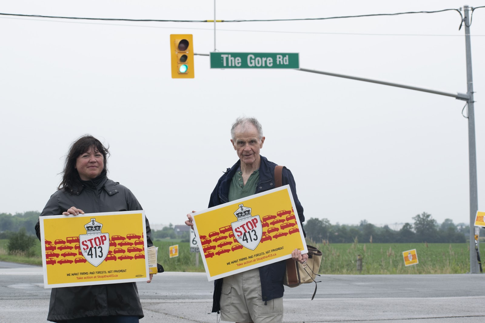
Caledon and Brampton are the only two municipalities dissected by the proposed Highway 413 that have not passed a motion in opposition to the project.
(Alexis Wright/The Pointer)
This is despite the fact that not all of the sitting councillors agree with this position. In February, two years after Groves’ initial motion was defeated, Ward 3 councillor Doug Maskell was gearing to bring forward a similar motion asking the Town to formally declare a position in opposition to the highway. After receiving multiple comments from community members who wanted to speak to the motion, Maskell decided to refer the matter to a later date, to have utmost attendance in hopes to gain the support of his fellow councillors. Given the past voting records of Caledon council, the vote could be a tight one, but Maskell said Caledon’s position is an important one. If Caledon does not formally oppose the highway, that will be used as leverage by the PC government to get it built, he expressed to The Pointer.
As for the OP itself, the three residents who delegated to council independently — there were other delegates who represented developers — asked for the Town to adopt a portion of the plan, while taking more time and effort to strengthen policies mainly related to the rural areas and the natural environment. The delegates stressed that the urban policies seemed to have a lot of work put into them, but the same could not be said for the rural policies.
Sinclair said he supported the approval of Sections B (Managing Growth and Change), C (Town-wide Policies), F (Urban System), and G (Implementation). The other delegates agreed that these policies were sufficient but that the other sections needed work.
One of Sinclair’s main concerns is the seeming transition from an ecosystem approach to a landscape features approach. The Town of Caledon was one of the first municipalities to adopt an ecosystem approach in 1994 when it came to assessing development. The type of strategy is one that integrates the management of land, water and living resources to promote conservation and equitable and sustainable development.
“This approach must emphasize that development not only protect and steward ecosystems but also strive to enhance and restore ecosystems in an appropriate manner,” the current OP reads.
But the new draft OP uses a framework that looks at natural and landscape features individually, creating a silo or vacuum of assessment when it comes to development.
“The notion of linkages between the features becomes a tack on to be optionally considered. The landscape Ecology approach is administratively convenient as through application of the definitions provides certainty to development application outcomes,” Sinclair wrote to The Pointer in a statement.
The landscape features approach would look at the impact of development on each natural feature individually, failing to assess a cumulative impact. If each feature does not require protection, development would be easier to proceed, decimating precious landscapes.
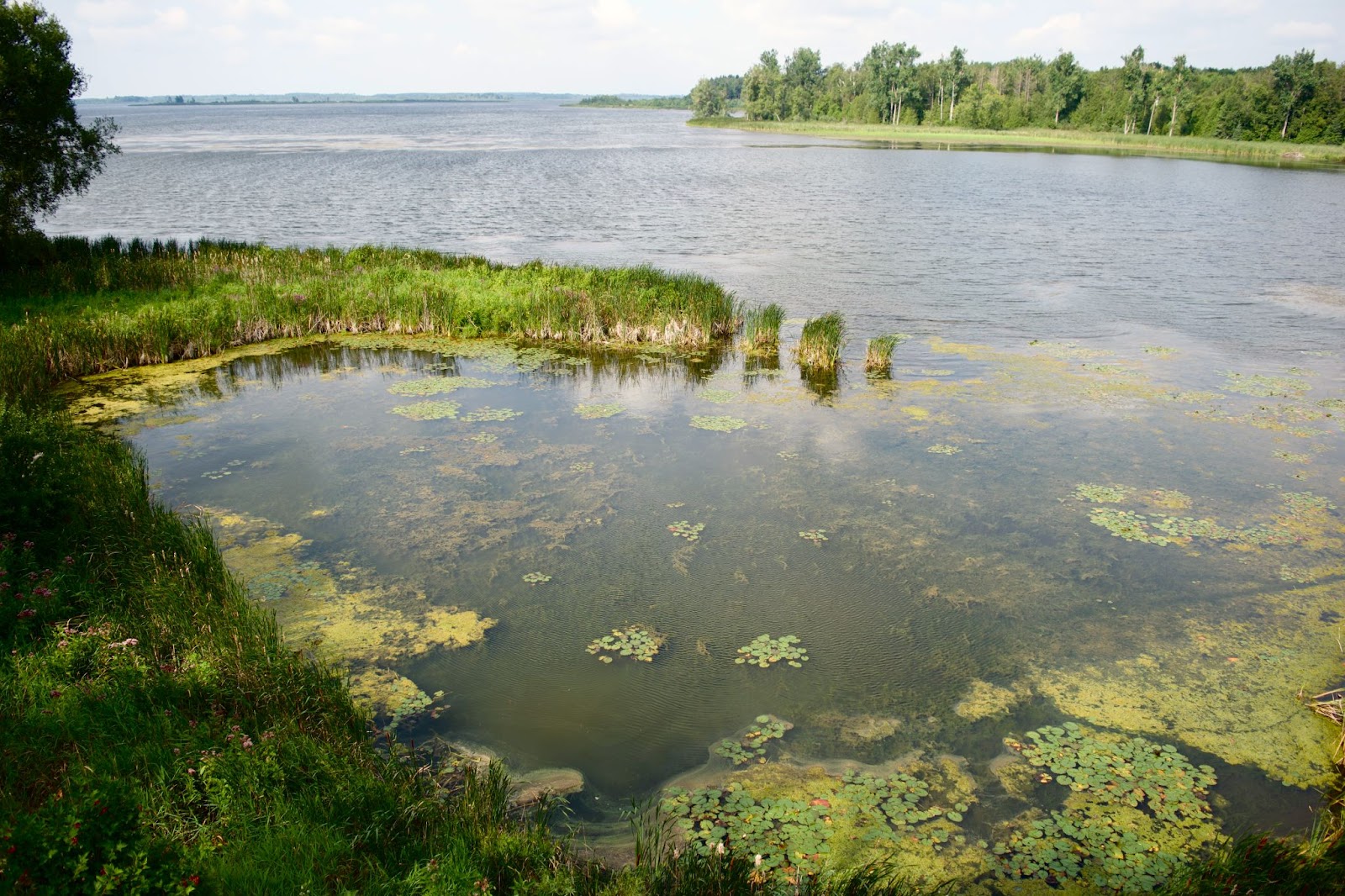
Wetlands are some of the richest ecosystems in terms of biodiversity making their protection crucial for sustainability.
(Alexis Wright/The Pointer)
This framework could have significant consequences in the wake of changes made to environmental legislation by the PC government over the past two years. Under Bill 23, the Ford government dismantled the Wetland Evaluation System (WES) making it significantly harder for a wetland to achieve protected status.
When attempting to determine if a wetland deserves protection, these natural features are evaluated on a scale between zero and 1,000. If a wetland scores over 600, it is considered provincially significant and is shielded from development. Bill 23 changed the evaluation criteria, making it harder for wetlands to tally enough points for protection. Among the changes, the presence of endangered species will no longer provide evaluation points to a wetland.
The changes also rid of the idea of a wetland complex which formerly evaluated smaller wetlands together in a larger sum increasing their chances of protection.
Prior to Bill 23 and enhanced within the 2022 Bill, the Ontario government is continuing to propose ecological offsetting as a sustainable growth strategy. Offsetting is the practice of creating a natural feature to account for the one that was lost to development. But the problem with offsetting is that not all landscapes function in the same way, so moving a wetland, for example, to a new location may not have the same ecological benefits.
While the dismantling of these features and the changes to the approach in the OP will have consequences for environmental protection, they also run the risk of allowing development in areas with a higher tendency for flooding or other disasters, things that will cost the municipality more money in the long run.
"I am concerned that chapter 13 [Natural Environment System, Parks and Open Space] is significantly weaker than the policies you already have," Jane Thompson said.
Part of chapter 13 sets out a mitigation hierarchy “where emphasis is placed on avoidance, followed by minimization and mitigation to achieving no negative impact before considering other options,” the draft reads.
Where avoidance can not happen, the town must try and mitigate the impacts of the development, work to restore the system, or enhance the system. Where none of this is possible, the final procedure includes replication or compensation of the system. Jane Thompson said this procedure makes sense for the urban areas but does not provide protection for the precious ecosystems in Caledon’s expansive rural areas.
There are similar discrepancies in the way that woodlands are assessed throughout the OP. Sinclair said he was thoroughly impressed with how woodlands were being handled in urban areas, but the same could not be said for rural woodlands. Instead, the continuation of the section set out criteria for when woodlands can be removed. One of the criteria for removal is that “the removal of a portion of woodland will not result in a negative impact to the ecological functions of the remaining portion”. But looking at it from an ecosystem approach, natural features function best in tandem and the removal of part will undoubtedly have an impact on the entire system.
“As a general comment on the new draft Caledon O.P. it lacks any imperative concerning climate change, diminished natural diversity or flood risks. It’s like we are back in the early 1950’s,” Sinclair said in an emailed statement to The Pointer.
For the natural features — including woodlands, wetlands and stream corridors — only core features that have already been identified and analyzed are mapped, leaving many other natural features open to development. Jane Thompson said that these governing policies are “subjective and ambiguous” and therefore “weak”.
Conservation authorities are crucial for identifying where development is at risk of hazards like flooding.
(Alexis Wright/The Pointer)
The delegates also identified issues with the section on man-made and natural hazards, identifying a lack of effort to protect communities and valuable infrastructure.
The draft declares that the Town will work with the Toronto and Region Conservation Authority to establish flood warning and evacuation systems, as well as relying on the body for mapping and flood risk protection.
Former Caledon mayor Allan Thompson, who delegated to council at the public meeting last week, said this collaboration eliminated duplication of policy and oversight with conservation authorities, but the other delegates were far more concerned about the weakening power of conservation authorities already.
According to Conservation Ontario, the body that represents the 36 conservation authorities across the province, the core mandate of these entities is to “undertake watershed-based programs to protect people and property from flooding and other natural hazards, and to conserve natural resources for economic, social and environmental benefits”.
Bill 23 removed the ability of these bodies to work with municipalities on watershed planning, including protection of wetlands and wildlife habitats, and protecting people from floods. The regulations “gag” conservation authorities, Environmental Defence says, by not allowing them to share information with municipalities as part of the land use approvals process.
But even before Bill 23 came onto the playing stage, the Ontario government was working hard to dismantle the entities that provide such important ecological services. In December 2020, the PCs rammed through Bill 229 and the controversial Schedule 6, which made a number of changes to the Conservation Authorities Act. It allowed developers to make an appeal directly to the Province should a conservation authority deny an application to build in a risky area. Under Schedule 6, Queen’s Park can issue a veto to force a conservation authority to issue a building permit, even if the science says the results could be catastrophic.
The three delegates also had immense concern with how the draft OP would impact the Town’s new aggregate policies. In 2022, the Town issued an Interim Control Bylaw (ICBL) on new aggregate development for the period of one year — in October 2023 the ICBL was extended for an additional year. The purpose of the ICBL is to buy the Town time to update its very weak aggregate policies in the face of new applications.
Jane Thompson, who sits on the Aggregate Resources Community Working Group, said she has concern with the natural features section of the OP being approved before the aggregate policies are complete. In the wake of a challenge of the ICBL at the OLT, the Town of Caledon estimates that its aggregate review will be completed by June or July.
On Tuesday March 19, a staff report recommending approval of the OP will be on the Planning and Development Committee agenda. If the recommendation is approved, the OP will be formally ratified at the March 26 Council meeting. Concerned residents can register to delegate at Tuesday’s committee meeting here.
Email: [email protected]
Twitter: @rachelnadia_
At a time when vital public information is needed by everyone, The Pointer has taken down our paywall on all stories to ensure every resident of Brampton, Mississauga and Niagara has access to the facts. For those who are able, we encourage you to consider a subscription. This will help us report on important public interest issues the community needs to know about now more than ever. You can register for a 30-day free trial HERE. Thereafter, The Pointer will charge $10 a month and you can cancel any time right on the website. Thank you
Submit a correction about this story
