
Saving the Huttonville Forest—Part 1
During the spring months, a small woodlot in north-western Brampton comes alive.
Trees begin to bud, green blades of assorted flora emerge as a blanket of snow melts. Animals reemerge and start families. Insects and microscopic organisms start the process to revitalize the natural landscape.
Standing among the trees, the encroaching sound of humanity fades off into the distance. Blue jays chirp away and the hypnotic song of the northern cardinal rings through the criss-cross of black ash, sassafras and silver maples.
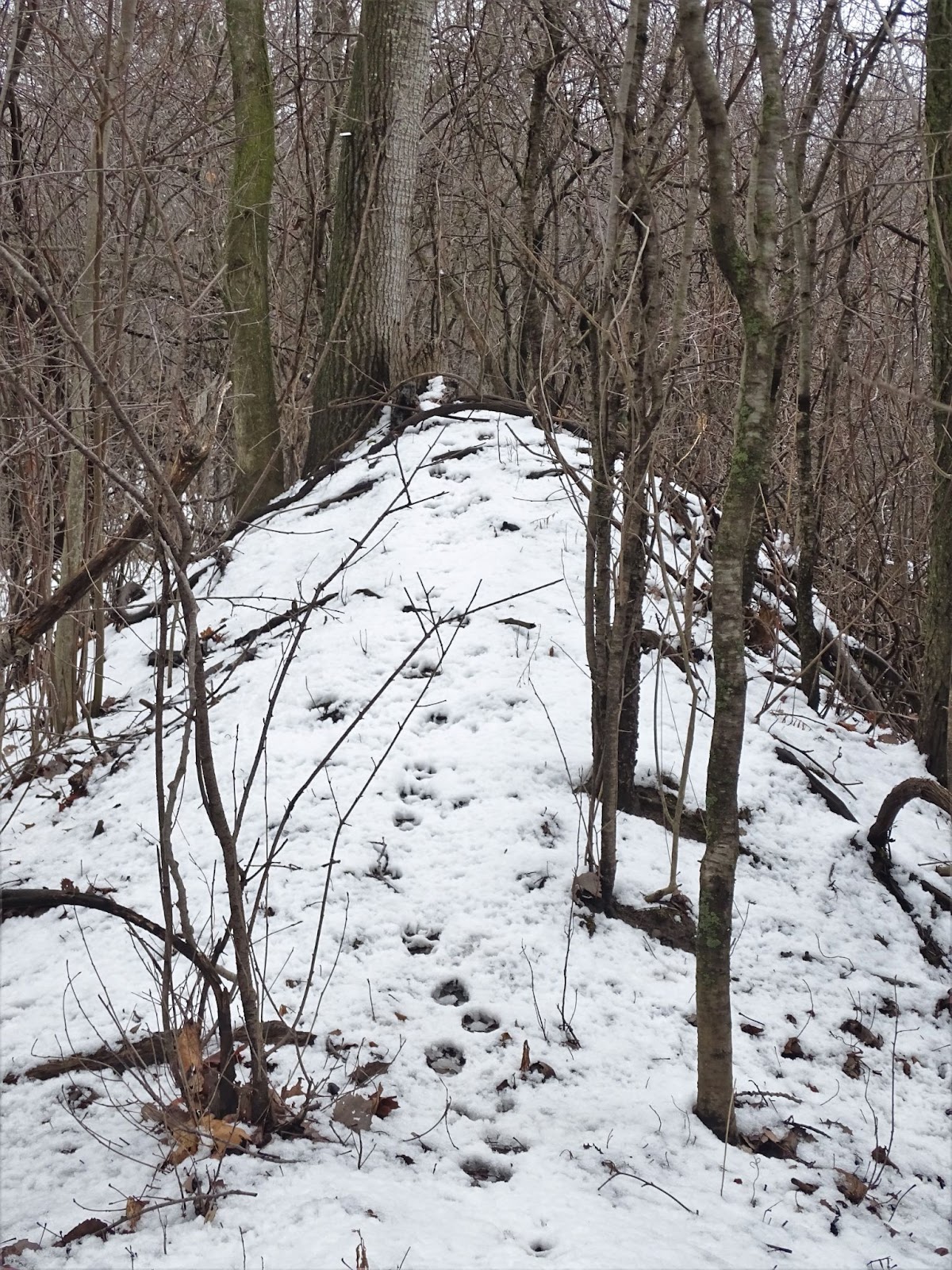
Coyote tracks through the Huttonville Forest. Documents state the forest provides little ecological benefit to the area.
(Natasha O’Neill / The Pointer)
As each day passes, the earth leans closer to the sun. More signs of life can be seen and heard. The chattering of chipmunks echoes off the trees. Squirrels dart between the cedars and pines. Chickadees flit from the branches of white birch, frogs splash in tiny ponds and the hollow drum of woodpeckers knocking signals they’re ready to eat as the wind rustles through newly born leaves.
Locals know this area as the Huttonville Forest, and many have been watching this small mosaic of Mother Nature awake from its winter nap for years.
But with each spring that passes, locals fear it could be the last for the Huttonville Forest. Development keeps pushing in.
Advocating for this unique piece of wooded greenspace is a group of local environmentalists. Ken MacDonald, the chair of the Huttonville North Residents Association (HNRA), was interested in the inclusion of a trail system through a proposed development when he discovered the forest sitting on the property would be destroyed.
Located on a mostly vacant farmer’s field between Embleton Road and Heritage Road, west of Mississauga Road, the cluster of trees is unnoticeable to many who pass by. The marvelous Credit Valley River cuts across the north of the lot, bending to the west and further away from advancing civilization.
It is situated near the far edge of the lot furthest away from the roads, close to the ledge where ground drops off to the rushing water below.
At 8:55 a.m. and 3:10 p.m. Monday to Friday, a school bell can be heard from the nearby Huttonville Public School on Embleton Road on the southern part of the site.
Julie Harlow, a local resident and member of HNRA, sent her three kids through the school, and often overheard them talking with friends about the forest.
This area happens to be part of a large transformative growth strategy called the Bram West Secondary Plan, encompassing 6,050 acres of land. The project has been stuck in the bureaucracy of local government and planning policies since 2006. According to staff reports, the project is going to be revolutionary for the area, bringing businesses, public institutions and a range of recreational and natural features to create an expansive mixed use community.
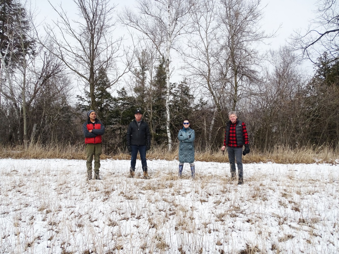
From left: Tushar Metha, Don Naylor, Julie Harlow and Ken MacDonald.
(Natasha O’Neill/ The Pointer)
“I actually physically won't look at it [the development]. I kind of took this as an issue [of] line in the sand thing, saying environmentally, this is wrong,” MacDonald told The Pointer. “I decided to spend a lot of my valuable time — as all these folks — for various reasons, but we're all concerned environmentally.”
Since there are so many moving parts to the overall plan, research and concrete decisions on specific parcels within the plan area are hard to obtain. The planning process has been long and has gone through many sitting councils and municipal bureaucrats no longer at City Hall.
Michael Palleschi, Ward 6 Councillor, has been in constant conversation with the HNRA. The Pointer reached out to him for his thoughts on the looming destruction of the forest.
“With regards to revitalization of the forest, I am a strong advocate for the environment and place a lot of value on development in conjunction with environmental stewardship,” he told The Pointer in an email. “The trees being removed from the subject lands will be offset by new trees that will be planted throughout the Riverview Heights Block Plan area, including restoration planting that will occur within the environmental buffers and within the Credit River Valley.”
He continued.
“This development has gone through a comprehensive planning review process, including required technical studies. Nevertheless, I understand the concerns that have been shared by some, and therefore am working closely with staff to ensure that the natural heritage system is enhanced through future restoration efforts (tree planting).”
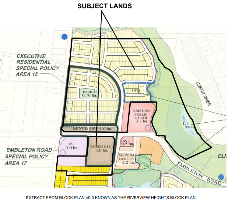
A 2020, updated block plan by Great Gulf Homes showcases packed residential areas, coming close to the Credit River.
(Great Gulf Homes)
Great Gulf Homes owns the land Huttonville Forest sits on. The company is one of six that own various plots of land from the Credit River to Steeles Avenue West, named Riverview Heights Sub-Area 40-3 in planning reports. Each developer owns land within the 391 hectares and each has its own design approach and components to shape the evolving community, as Brampton continues to welcome rapid population increase, largely due to the desire of developers who bought up most of the untouched land years ago, and are now pushing to capitalize on their investment.
The entire area will consist of 2,344 units, a mix of single, semi, townhouse and apartments, six schools (two secondary and four elementary) and one church (it’s unclear if places of worship will reflect the demographic reality of Brampton). Approximately 15 hectares will be dedicated to employment, and 81 hectares of open space, free from residential or commercial features.
The land north of Embleton Road that holds Huttonville Public School and the forest is identified in Brampton’s Official Plan as an “upscale executive housing special policy area.” Meaning the lots must be divided up into no less than 5,000 square foot parcels for future houses to abide by the zoning. The area will be cleared and have low-to-medium-density housing, fitting into the category of further sprawling development environmentalists are urging cities to leave behind.

A 2012 Riverview Heights Plan presents the entire development from Steeles Avenue to the Credit River.
(City of Brampton)
“They should be looking at small eco-developments and leaving maximum nature instead of these gargantuan houses that take more material footprint,” Tushar Metha told The Pointer. He is an emergency room doctor at Brampton Civic Hospital and an active environmental advocate in Peel Region including being a part of HNRA.
Huttonville Forest is just one of the natural elements that will be completely destroyed in the process of urbanization. Local community environmentalists have made it their mission to save the small forest, but without support from the Credit Valley Conservation Authority (CVC) and the City, the possibility of saving the trees looks unlikely.
To locals and those unfamiliar with the planning process and CVC’s authority in the matter, it can look like the organization is not doing enough to prevent deforestation and environmental degradation. However, the conservation authority can merely suggest areas of concern and holds little to no weight when it comes to forcing developers or cities against making decisions that could harm the natural features of an area.
“CVC’s role in the municipal planning process is to coordinate our permitting requirements (for natural hazards) in accordance with Ontario Regulation 160/06, in an effort to avoid duplication and delay in subsequent processes, as well as to provide technical input on natural heritage and other non-natural hazard related items as requested by the municipality or as identified through Memorandums of Understanding (MOU),” a spokesperson for CVC told The Pointer in an email.
The land used to be a functioning farm field, holding crops of wheat for feeding animals—a history that stretches back to Chinguacousy Township around 1819. James Ostrander was awarded the land after participating in the War of 1812. The family stayed on the plot, eventually building a house and barns for farming.
In 1945, Noah Ostrander (grandson of James) sold the land to Leonard Butt who operated a Jersey dairy farm and pick-your-own flower business. In 2005, Butt sold the plot to Great Gulf. Developers were aggressively buying up land at the time, as Brampton leaders made it clear the city was open for growth, and all the money it would bring.
“I knew the family that lived and managed this farm. They still come to the Brampton Farmers Market every year. They're up in Wellington County now, ” Harlow said. “Farmers are getting squeezed out of here. They make it so hard to be a farmer in this city.”
A few years later a heritage impact assessment was done on the Ostrander house which was deemed a good example of an early vernacular brick farmhouse, with beautiful accents and other features of a bygone time, like its stunning balcony.
“Numerous exterior and interior architectural attributes are identified,” reads the assessment by Unterman McPhail.
Less than two years later a fire destroyed the Ostrander Farm House, wiping the land of the last memory of its farming history. Today, the forest represents the only remaining natural feature of the land, throughout its history, and remains an important natural and historical part of their surroundings for the locals who live here.
In the cultural heritage assessment that was conducted, the historical association was “manifested in the Farm House.”
In 2011 an Environmental Impact Study (EIS) was completed by SLR Consulting (Canada) Ltd. It assessed every woodlot, wetland and watercourse within the Riverview Heights area and gave detailed mapping of the forest. Not to be confused with an Environmental Assessment (EA), an EIS specifically defines the activities on the land and how it will affect the surrounding environment. An EIS informs the removal of natural features.
Huttonville Forest does not have a name in the assessment, instead it’s called Vegetation Unit B - Cultural Woodland/Thicket. The EIS has to justify why the specific tree/vegetation or wetland should be removed. The development benefits need to outweigh the ecological benefits.
According to the report, the forest had been disturbed prior in history by human activity. Since it grows on the edge of a farm field this is relatively unsurprising. It describes the forest as being small and young, and explains how it could be “replaced” elsewhere on the land.
The EIS states Huttonville Forest is, “considered to be low function with a low requirement for protection.”
Among the trees are large craters. The land dips down in the northern part of the forest, in one specific section. The highest part of this land is called “top of bank” and follows the curve of the ravine toward the river edge. One side of the ridge has mature trees that have formed on the slope toward the river, the other side a young forest has been deemed low functioning.

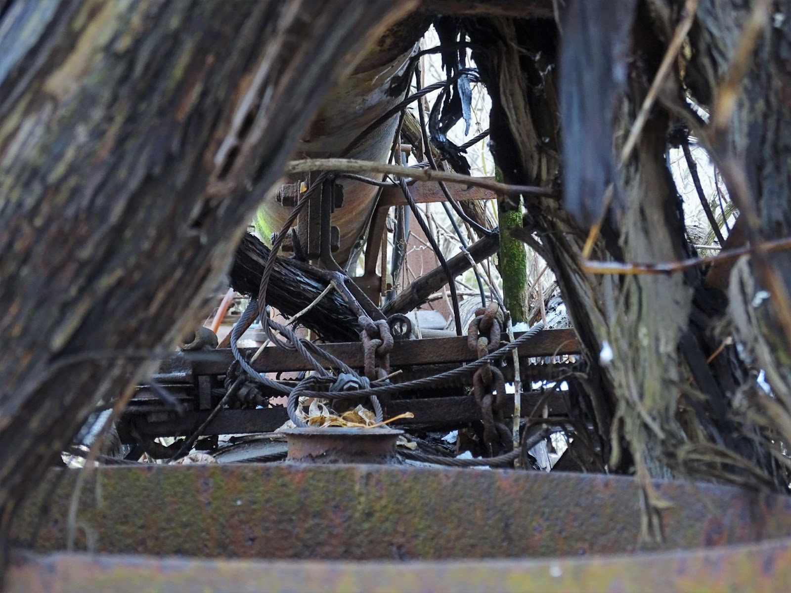
The land has been disturbed by digging. Trees have grown inside the holes filled with grass and vegetation.
(Natasha O’Neill/ The Pointer)
The EIS says Huttonville Forest is, “not a historical extension of the very important trees on the slope.”
In 2019 a Table Land Tree Inventory/Preservation Plan & Edge Management Report was presented to Brampton as recommended in the EIS. It laid out precautions the developer needs to take to mitigate any effects to the trees along the wall. A 10-metre buffer is needed from the end of a rear lot to the edge.
“The various setbacks result in the proposed houses being situated more than 133 metres from the west edge of the Credit River and over 255 metres from the property limits of the existing residents [across the valley],” the 2019 management plan reads.
Great Gulf needed to showcase how the area could support stormwater drainage during one of the preliminary studies. The uneven ground in the forest required “extensive grading” forcing a limited option to preserve trees.
Past reports on the land have explained soil was taken for the construction of the 407, which occurred in the late 1990s. Knowing that, the holes are just over 20-years-old, but it’s hard to tell.
Despite being touched by humans, the forest has bounced back. Trees have grown in the area, grass has formed a thick layer on top and the section provides brush coverage for woodland animals to nest.
“My husband and I walked across [the river] and came up through the valley and up into the forest,” Harlow said. “It was a totally different perspective. You come from nature to nature so it seems more like a cohesive forest rather than coming from some cultivated field.”
Using the Ontario government’s Natural Heritage Information Centre (NHIC) website, The Pointer found four species threatened or endangered in the area of the development.
The endangered redside dace has been found in this portion of the Credit River. Habitat loss caused by urban and agricultural development are the “most significant” threats to the fish, the Ontario website explains.
Protecting the river from further pollution and habitat loss affects the snapping turtle, a species listed as special concern. According to the government’s website, it takes a long time for this type of turtle to be fully grown, making it very important to keep them alive before they have offspring. The biggest risk for them are vehicles since they are often too slow to move out of the way.
The Eastern meadowlark, a threatened species, lives in grassy, wide open areas. It doesn’t mind small trees and can be found near orchards, crops and overgrown fields. The migratory songbird has a perfect habitat in the overgrown, natural areas around and in Huttonville Forest. In the last 40 years the meadowlark population has decreased by almost 65 percent in Ontario.

Nooks inside trees like this offer great habitats for small woodland creatures.
(Natasha O’Neill/ The Pointer)
The Butternut tree is labeled as endangered, and unlike most species it is being threatened by a fungal disease. Even though humans may not be directly harming the trees, increasing stress on them makes it more difficult for trees to fight the disease.
Wild Coffee (Triosteum aurantiacum) a “locally rare species” was found within the forest in 2011, but a search in 2019 found none.
CVC does not have jurisdiction to comment on endangered or threatened species in the area, which would fall to the Ministry of the Environment, Conservation and Parks under the Endangered Species Act responsible for the careful consideration.
Among other reasons for the demise, farm equipment and “other debris” is on the land including some asphalt and beekeeping equipment. A tractor is found abandoned on the southern edge but the trees have embraced it as their own.
“It's been here for a very, very, very long time and they made it sound like this insurmountable thing to get rid of all this stuff,” MaDonald said. “I mean, I own a little John Deere [tractor], I'd have a great little project cleaning this up and it would take me no time at all.”
Huttonville Forest sat quietly without being distrubed by humans, but activity by birds, squirrels and pollinators did not rest. The EIS explains the area had been colonized by non-native species and “habitat quality is marginal and culturally influenced.”
A previous report by Gartner Lee Limited (GLL) in 2007 shows initial interest by CVC on the forest. On August 15, 2007 GLL ecologists visited the site to undertake a mapping and description after CVC requested it at an earlier meeting. Similar to the 2011 EIS, the report explains the “large pits” and “numerous mounds” of soil around the northern end of the forest.
It harshly describes the “debris” being dumped around the site, including mention of the asphalt, farm equipment and apiary (bee hive).
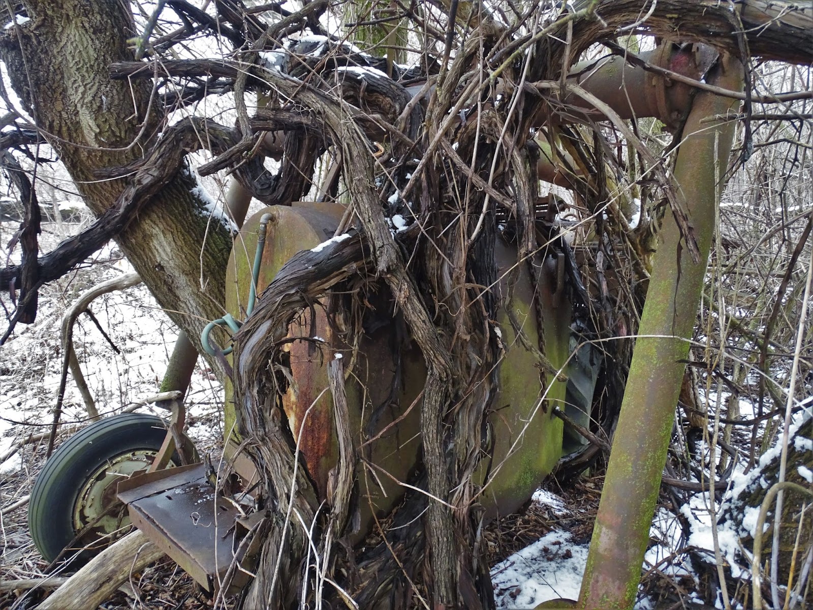
A very old tractor left to rust in the back field has been embraced by the vegetation.
(Natasha O’Neill/ The Pointer)
According to the 2007 report, “much of its function can be replicated elsewhere,” to specifically “enhance features” and “provide a net gain.”
What is more disturbing than the fact the forest is being written off because it doesn’t provide a net gain, is the fact the report goes on to list numerous species of trees beneficial to animals, insects, ecosystems and humans.
“The interesting thing about it is an ecologist comes along, and says ‘it's been disturbed’ and that means it’s low functioning and not worthy or not valuable for preservation,” Don Naylor, a member of HNRA and landscape architect, told The Pointer. “They create this chart checking off all the reasons why they said it's not worthy of preservation. Well, that's a subjective opinion, I can come back to the same thing, and give you all the beneficial reasons why it should be preserved.
That is the issue, nobody has ever given this forest block credit for Mother Nature's job rehabilitating it and turning it into the forest feature that it is,” he said.
Found in all the meadow areas inside the forest is Canada thistle (very similar to the bull thistle), named a noxious weed by the province of Ontario. However, its purple flowers provide seeds to birds and are a favourite to butterflies and bees.
According to the report, the Manitoba Maple is “invading” the edges of the area, despite the Government of Ontario saying it is “best used as a restoration species.”
On the western edge of the forest there are also numerous species that can provide benefits to the area:
-
Trembling Aspen: create “expansive colonies” with some trees in the United States dating back to 80,000 years
-
Silver Maple: a fast growing tree often providing shade
-
White Birch: a source of food for birds and animals which eat the leaves, buds and seeds
-
White Pine: in the past has been used to make ship masts
-
Red Pine: good solid habit for animals since the roots are very strong
-
Balsam Poplar: bees sometimes use the resin to disinfect their hives
These trees will all be extracted because of the “corrective grading” needed to mitigate the safety issues from the depression areas.
“The applicant retained qualified consultants to review this cultural woodland in detail. They provided detailed assessments of the cultural woodland, its quality, and provided management recommendations based upon the applicable policy frameworks. CVC staff base their review of planning proposals such as this on provincial, regional, municipal, and CVC guidelines and policies – considering our expertise, experience, and knowledge of natural heritage and water resource systems and their functions throughout our jurisdiction,” a spokesperson from CVC stated in an email.
A row of White Birch can be seen on the outside of the forest.
(Natasha O’Neill/ The Pointer)
While the forest, and meadow are deemed invaluable by ecologists, a small wetland within is also being destroyed. These precious ecosystems have been destroyed for years across Ontario, and have had detrimental effects on the surrounding environment and animals.
As a result of Ontario’s booming growth, the majority of the province’s wetlands — 68 percent — were destroyed before the early 1980s. A further 4 percent has been lost since then, the majority in major urban centres.
Wetlands don’t just provide habitat for animals, they are also valuable to humans by soaking up carbon dioxide in the atmosphere. Wetlands also filter water and have flood mitigation potential. In the Credit River Watershed, wetlands alone provide $186.8 million in value, and trees, shrubs and other vegetation realize approximately $5 million in value, storing 175,000 tonnes of carbon and removing 292 tonnes of air pollution annually.
The locals call it a wetland, but reports deem it CPa or Pond 1. The EIS characterized the area as being “low functioning” due to the high algal content, possibly due to chemicals from the farmfield and fluctuating water levels on the site.
“These ponds are dug irrigation facilities and have consistently been assessed as contributing low ecological values that could be replaced through the wider Block Plan approval process,” the report states.
What makes this all the more surprising is this specific wetland has been deemed “locally significant.” According to a regional spokesperson the determination of this is based on definitions and criteria in the Region’s Official Plan with information from the cities’ official plans.
“The policies and criteria in the local municipal official plans apply with respect to woodlands that are considered 'locally significant' (i.e. are not Core woodlands but still deemed to be significant in accordance with provincial policy),” the spokesperson said in an email to The Pointer. “The Regional Official Plan direction is that the local municipalities are required to further interpret, identify, protect, restore and enhance non-Core woodlands in accordance with the intent of the Regional Official Plan consistent with provincial policy.”
The Region explained inside the Official Plan there is set criteria to determine if a woodland is a part of the Core Area. According to the plan, woodlots identified within the Core System must be under 16 hectares in rural areas and under four hectares in urban areas. The woodlot must have at least 0.5 hectares of “native trees” older than 100 years and contain extremely rare to uncommon or critically imperiled to vulnerable species of plant/animal.
The Pointer is unable to confirm if Huttonville Forest fits this criteria, however The Region has included it in its mapping of the Core Systems.

In 2014, Peel created a map of the Core Areas of the Greenland Systems, which includes the Huttonville Forest.
(Region of Peel)
“The policies introduced in the Regional Official Plan were not in effect at the time that the block plan for Riverview Heights (Block Plan BP 40-3) was approved as the Block Plan predates ROPA 21B,” a Regional spokesperson said. “The City of Brampton Official Plan policies that were in effect at the time would have applied to the review of the Block Plan and protection of the Huttonville Forest woodland.”
The EIS lays out a credible reasoning for removing the wetland. The report explains few creatures have been seen inside the pond (three to be exact) and the reasoning is likely because of the “well-connected” habitat along the Credit River.
Wetland ecosystems are complex and very delicate, which is part of the reason they have quickly declined. Even the slightest change in atmosphere, water or disturbance can rapidly rid the area of life. While the wetland has a title of “locally significant” it doesn’t hold much weight.
A natural feature being designated “provincially significant” is a much different story, in fact it is the sole reason why the pond directly next to the locally significant wetland is being spared.
According to the Ontario Government’s website, wetlands are ranked by the Ontario Wetland Evaluation System. From there, experts can determine if the specific wetland should be designated and given special protection against any disturbances. A provincially significant wetland (PSW) designation, in theory, can restrict land use activity on the site and essentially creates a barrier around the land feature.

A locally significant pond is much larger than the provincially significant wetland which is further north behind the last row of trees.
(Natasha O’Neill/ The Pointer)
It doesn’t take a scientist to notice the two separate wetlands are in fact right beside each other, and harming one will likely have effects on the other.
“A Provincially Significant Wetland (PSW) is also located adjacent to the proposed development, which will be protected and any residual potential negative impacts mitigated for accordingly,” CVC said. “It should be noted these reviews included assessing potential impacts of the removal of the man-made pond beside the PSW.”
In order to spare the PSW, the other will be “filled with fill” matching the area around. What locals fear is the trucks of soil, destruction of nearby trees and increased human activity will harm the PSW.
These similar instances of governments or developers believing they can create projects near wetlands and failing is extensive. Just take for example Highway 413 and the Bradford Bypass, both provincially pushed projects going to degrade the environment around them.
With the increased awareness of ecosystems through local advocacy against harmful environmental projects and research and understanding from experts, it’s near impossible for habitats to thrive near humans without adapting.
Some systemes like wetlands aren’t able to adapt, making the degradation of it slow until it ceases to exist the way it used to. While some species can adapt to urban environments, some will fade away leaving only a fraction of the wonders it used to hold.
Locals are aware of these plans and hope the fate of the wetland and Huttonville Forest is seen as a lesson. While the area is small (2.6 hectares in total), and according to reports highly fragmented, it shows the wonder of how nature can bounce back once being touched.
“Human beings didn't contribute to the regrowth of this area, Mother Nature did,” Naylor said.
If left alone, trees will form around debris, grass will cover asphalt and animals will come back to the area.
Locals know Huttonville Forest provides cover and food for animals, and the trees and plants are growing stronger each year. To them, the destruction of the forest is not about the one habitat, it is about the bigger picture.
Developers and cities are guilty for pushing sprawl even in a time of planetary destruction through climate change. Huttonville Forest is just the latest casualty in the mass murder of the natural world.
October 28, 2020 the City of Brampton approved an Official Plan Amendment during the pandemic less than two days after it was approved to the Planning and Development Committee, solidifying the forest’s destruction.
The question advocates want to raise is when will it be enough? Or are humans destined to take away every last woodland, pond and meadow and creep closer towards protected areas like the Greenbelt or Oak Ridges Moraine?
Saving the forest and revitalizing it through delicate practices is not difficult and has been done. So locals struggle to understand why or how this forest was deemed not important. They want to have Huttonville Forest see every spring for the next 100 years.
Email: [email protected]
Twitter: @taasha__15
COVID-19 is impacting all Canadians. At a time when vital public information is needed by everyone, The Pointer has taken down our paywall on all stories relating to the pandemic and those of public interest to ensure every resident of Brampton and Mississauga has access to the facts. For those who are able, we encourage you to consider a subscription. This will help us report on important public interest issues the community needs to know about now more than ever. You can register for a 30-day free trial HERE. Thereafter, The Pointer will charge $10 a month and you can cancel any time right on the website. Thank you
Submit a correction about this story
