

‘The forest is gone’: Brampton residents still fighting for what remains of Huttonville Forest
“I'm out of fight,” Brampton resident Don Naylor said, looking despondently at the majestic trees of Huttonville Forest now lying lifeless in tangled rows of severed trunks and splintered limbs.
For four years he fought like a parent would for a child to protect them.
“The ship has sailed on saving the forest. There is no saving the forest. The forest is gone. The process is finished.”
The anger bled through his words.
Naylor has lived opposite the once magical forest for more than 30 years. He has sipped his morning coffee while staring out at it. He has walked its depths and learned its history. He has watched the canopy cycle through the life of each season, from green to maple-red, then gold, to green again.
It stood tall, defied the awesome power of Mother Nature under some of the harshest conditions she could conjure.
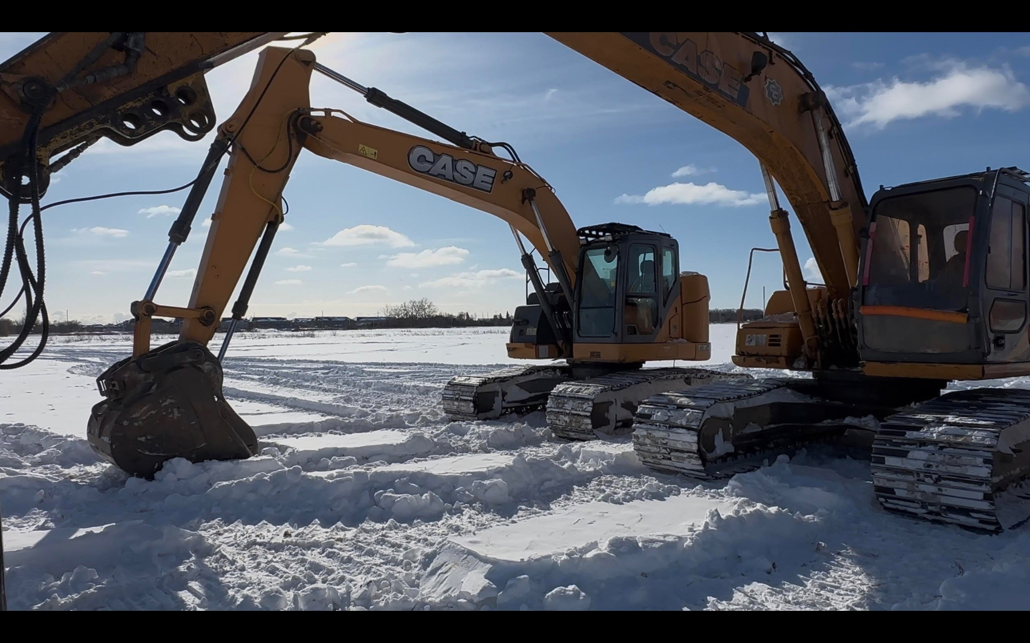
And then, the chainsaws and woodchippers arrived.
In what felt like the blink of an eye, what was once a dense, glorious woodlot in northwest Brampton, part of the historic Huttonville area fed by the Credit River, was vanished.
Residential development will soon rise, not too far from Heritage Road. Highway 413, if the politicians and builders complete their scheme, would slice its way through this last frontier of Brampton.
His neighbour, Julie Harlow, whose backyard backs directly onto Huttonville Forest, woke up in late January to the screeching grind of a woodchipper.
The sound echoed across the tree-lined neighbourhood, long a quiet haven tucked away from Brampton’s rapidly advancing urban sprawl.
The mechanical shriek cut through the crisp winter air, drowning the birdsong and wind chimes residents had heard dancing through the branches for decades.
“It almost felt like a panic attack,” Harlow said.
The noise sent her tumbling back 35 years, a jarring contrast to the scene when she arrived in Huttonville with her husband, Gavin Carrow, a Canadian amateur wrestler who competed at the 1992 Olympic Games.
“We moved here a year before my husband went to the Olympics. At that time, it was really a farming community. There was a post office in Huttonville and everyone knew who was going to the Olympics. They were so thrilled for us,” she recalled.
Harlow remembers how the local fire chief personally came by their home and encouraged Carrow to join the volunteer fire hall. He did, serving for ten years.
“That was the kind of place it was.”
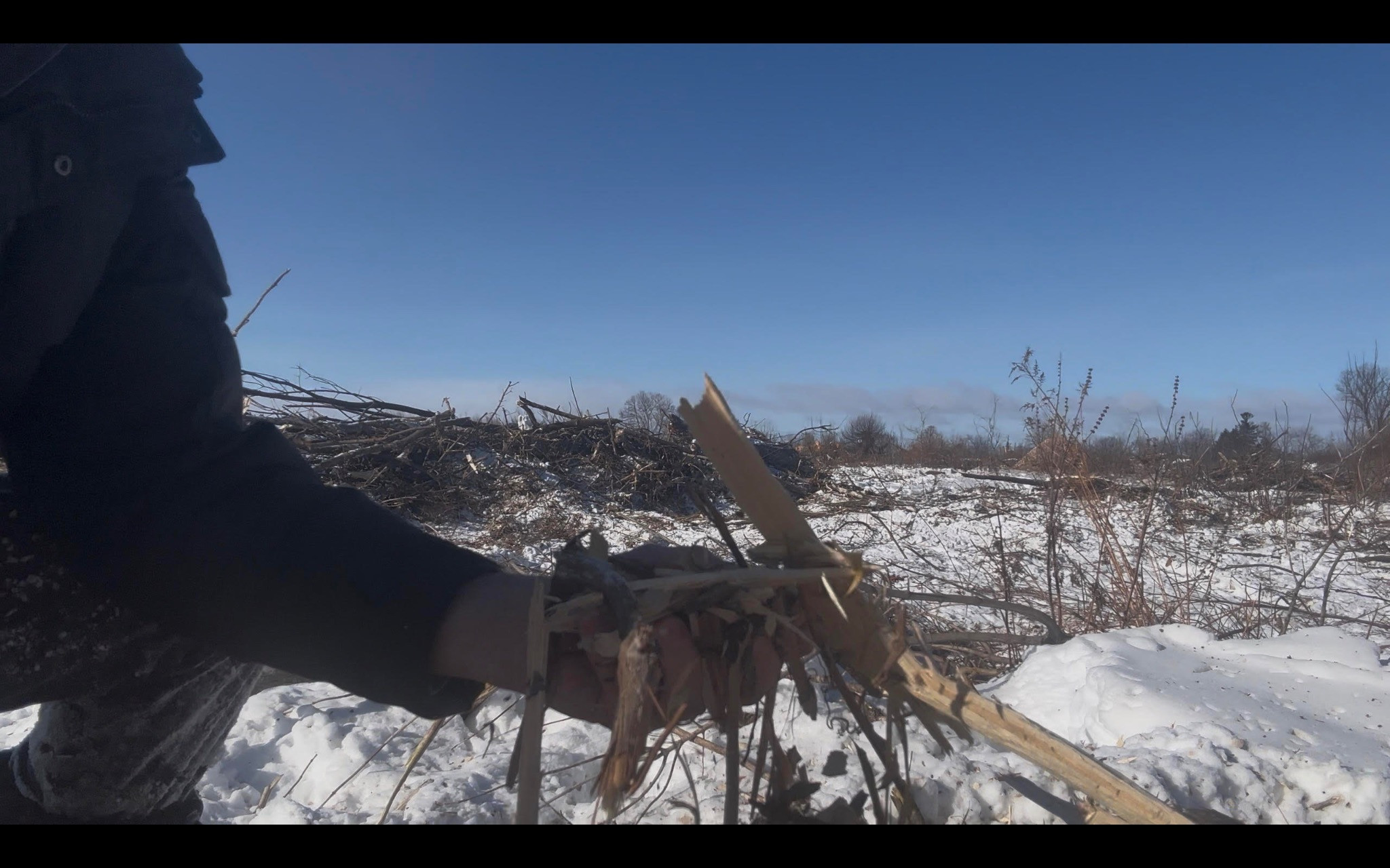
The Huttonville Forest reduced to woodchips.
(Submitted)
There was a dairy farm next door and neighbours could watch the cows being milked. Fields stretched invitingly between homes. Giant trees lined the properties. It felt rural. The encroaching city might have swallowed Huttonville’s boundary, but not its spirit.
“All of those things that were central to the community are drastically different now,” Harlow said. “The fire hall is gone. The farms are being torn apart. The farmland is disappearing.”
An avid gardener who grows vegetables and flowers, Harlow notes “the pollinators are gone” as a result. She now often has to do the work of the worker bees herself, getting even more intimate with her plants.
“Those are the things you start to notice. It makes you feel like they’ve totally attacked the environment here.”
Harlow said the noise of the machines, brought to kill the trees, was so paralyzing, making it impossible to work from home, that she had to temporarily relocate to her mother’s house in Burlington.
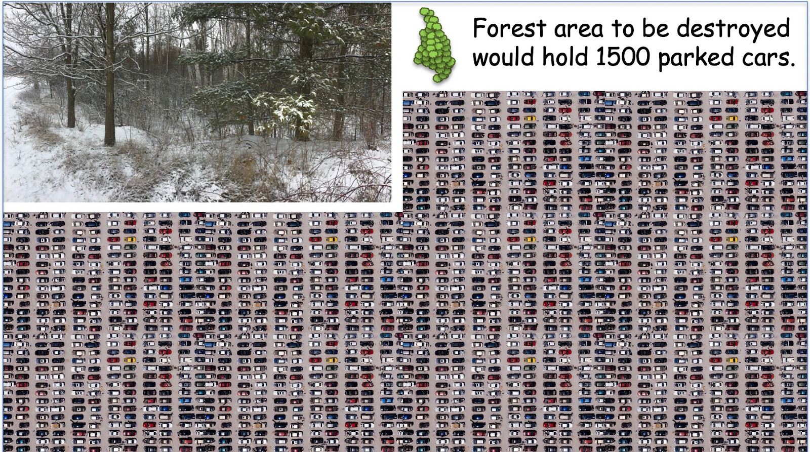
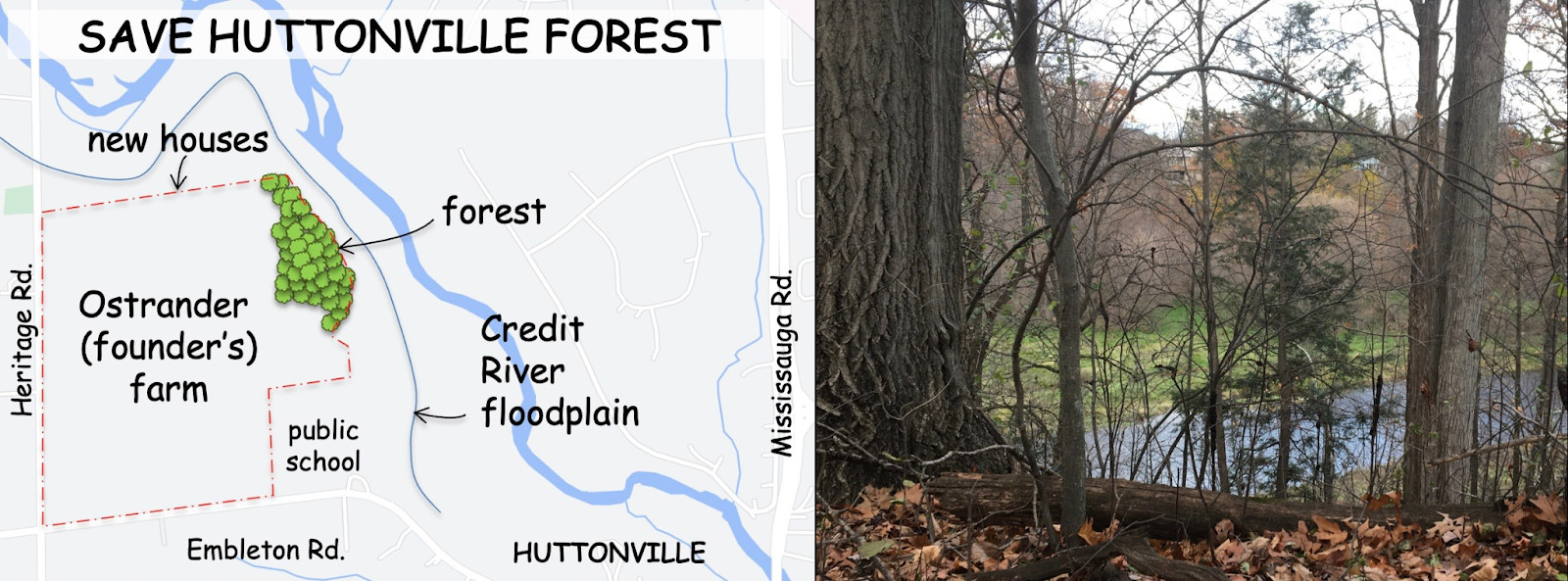
Huttonville Forest, covering 2.6 hectares, roughly the size of 17 NHL hockey rinks, stretched 300 metres along the south edge of the Credit River behind Huttonville’s oldest farm at Embleton Road and Heritage Road.
(Save Huttonville Forest/Facebook)
Naylor, who recently retired after more than four decades as an environmental planner and landscape architect working with developers, says he knows how the game is played.
“I spent my whole life trying to get developers to see the value of preserving green, and I won some, and I lost many.”
The fight, he vows, is still in him.
“But I won't change. The reality of this is that we lost because the developers won and the city let them get away with it.”
It all started in 2021 when Ken MacDonald, chair of the Huttonville North Residents Association (HNRA), an avid runner, was on the hunt for future trail connections near his River Road home to enjoy nature, find the solace of a green space the community could embrace and also extend his runs with his wife.
While searching the City of Brampton’s planning documents, something didn’t add up. He overlaid subdivision proposals onto Google Maps imagery and noticed 37 houses plotted directly over the thick forest overlooking the Credit River.
Digging further, he discovered that the land had effectively been released for housing on January 28, 2010, through an amendment to the BramWest Secondary Plan.
The change shifted protected green space into developable land without clear public disclosure.
MacDonald reached out to his neighbours and members of HNRA. Together with Don Naylor, Julie Harlow and Tushar Mehta, they launched the Save Huttonville Forest campaign to investigate how roughly three hectares of protected green space with a locally significant wetland along the river’s edge ended up in the hands of developer Great Gulf Homes.
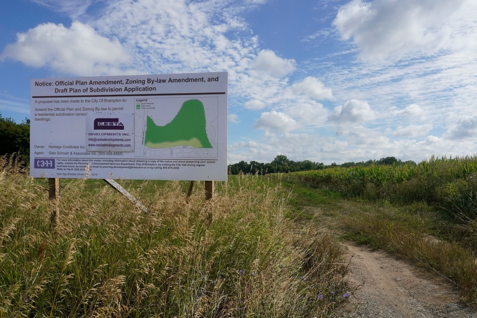
During a 2018 public meeting, the materials presented did not clearly disclose that the housing layout overlapped the “thriving” forest block. The HNRA noted public input was largely ignored and notice requirements were not expanded to nearby River Road residents despite a formal council request.
MacDonald questioned why the only visible reference to the transfer was an arrow on a planning drawing pointing to a “boundary change”.
The HNRA argued this action effectively converted public-designated green space into 37 estate lots, creating an estimated $50 million windfall in serviced lot value for the developer. The City has not confirmed that figure.
City records also revealed that the draft plan went through five revisions between 2006 and 2020 with only one public notice issued during that period.
The “game” that Naylor referred to had been unfolding behind the scenes for years with much of it uncovered by the HNRA, only after filing a freedom of information (FOI) request.
The association found a 2007 report by consultant Gartner Lee and a subsequent 2011 vegetation report by SLR Consulting (Canada) Ltd. that repeatedly characterized the forest as “low value” or “low quality”, a designation residents continued to strongly dispute throughout their years-long battle to save the heavily wooded area.
City officials had directed consultants to treat the forest as “Valleyland” rather than “Tableland”, which exempted the developer from Brampton’s Tableland Tree Inventory requirements (part of the City’s Urban Forest Management Plan) and meant no monetary or replanting compensation was required for tree removal.
But monetary compensation could not replace the ecological, social and historical value of the forest, the residents said.
On November 25, 2010, CVC planning ecologist at the time, Adèle Labbé (who now works as a Science Advisor at Fisheries and Oceans Canada), wrote to CVC’s then acting senior planner, Dorothy Di Berto, advising the forest should be considered a “significant woodland” and “protected”.
“CVC staff are of the opinion these units require consideration as part of the significant woodland and/or functional adjacent lands,” Labbé wrote.
“Based on the description provided in the [Environmental Impact Report], the plantation may not qualify as woodland due to the understory exhibiting invasive species only, with little complexity. This can be easily confirmed through a site visit with CVC staff. The Cultural Woodlands contiguous with the significant woodland in feature B…however appear to qualify as part of the significant woodland.”
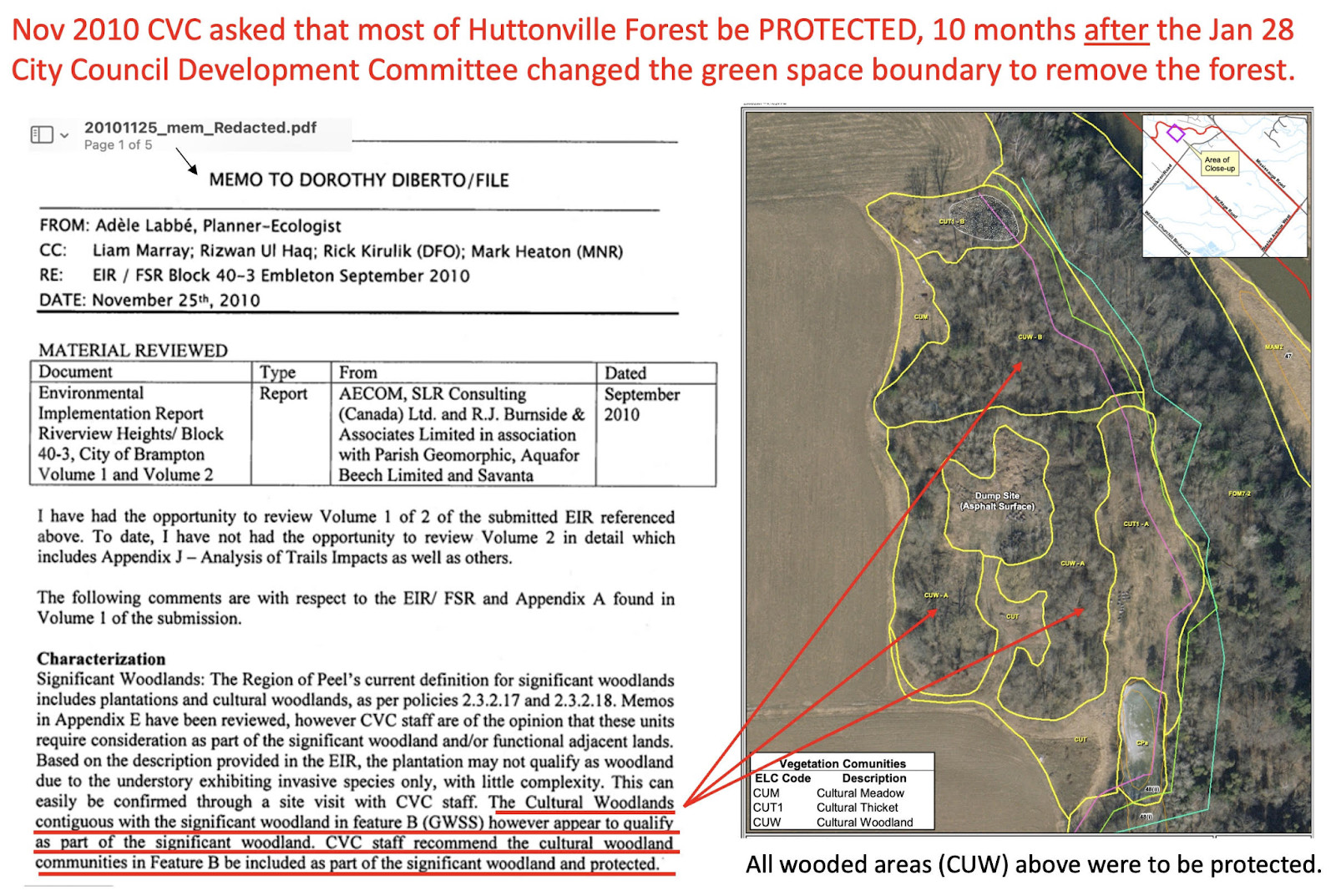
In a memo dated November 25, 2010, a Credit Valley Conservation ecologist urged for Huttonville Forest to be recognized as a “significant woodland”. While portions of the plantation had a simple understory dominated by invasive species, the contiguous Cultural Woodlands clearly qualified as part of the significant woodland, the memo noted.
(Top: Alexis Wright/The Pointer, Bottom: Submitted/Ken MacDonald)
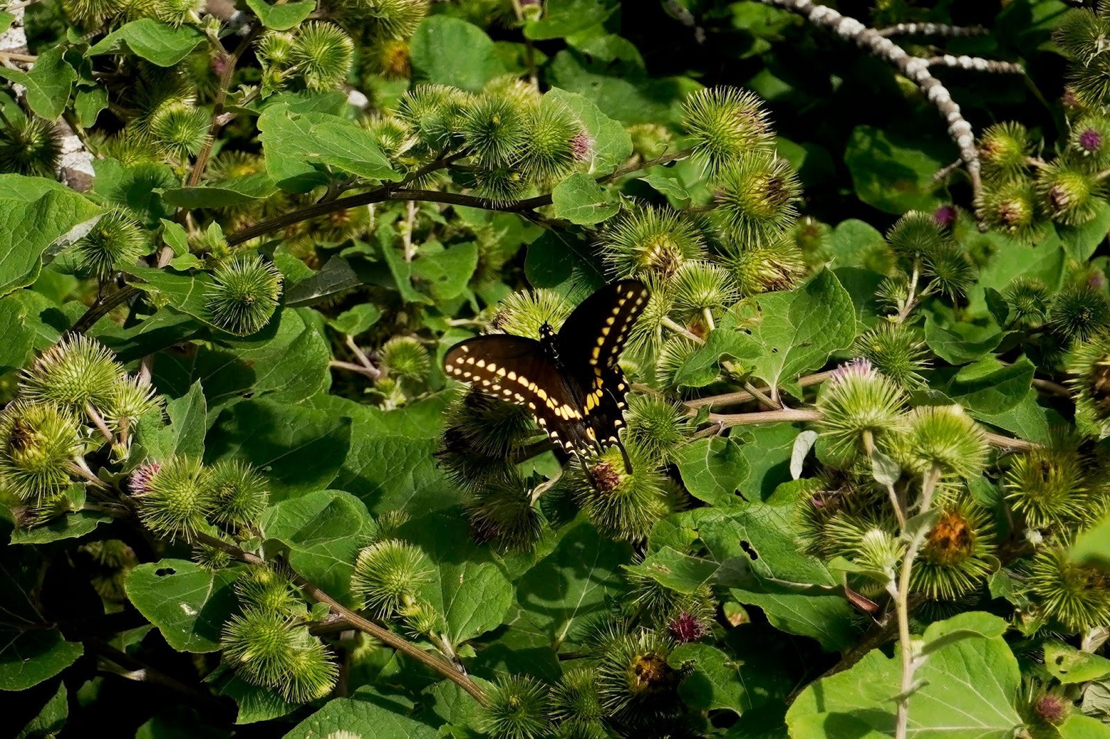
She highlighted the area was home to many endangered species. In one case, one of those species was found in “at least two woodlands”. A previous investigation by The Pointer found four threatened or endangered species in the area of the development including the redside dace, the Eastern meadowlark and the butternut tree.
Labbé also raised concerns about another locally significant wetland (identified as C3(x), part of the Levi Creek Subwatershed) on lands adjacent to Huttonville Forest, south of Embleton Road, also owned by Great Gulf.
"The conceptual compensation proposed for the removal of wetland C3(x) is not acceptable," Labbé wrote.
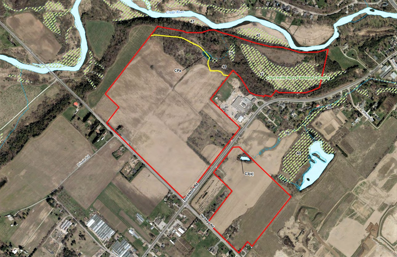
A conservation authority expert had raised concerns over a nearby locally significant wetland, C3(x) in the Levi Creek Subwatershed, warning that the developer’s proposed compensation for its removal was “not acceptable”.
(Great Gulf)
Eight months later, SLR consultants found the forest was not ecologically beneficial (despite including non-invasive tree species like the Manitoba Maple, White Birch, Red Pine and Balsam Poplar in their own report) and deemed the locally significant wetland to be “isolated and of poor quality”.
The Environmental Impact Study (EIS), completed by the firm in 2011, called the forest "highly disturbed" and "considered to be low function with a low requirement for protection" with portions of soil on the north end of the forest disturbed due to Highway 407 construction.
Internal correspondence showed that shortly after the EIS was completed, Joan MacIntyre of Malone Given Parsons Ltd., the planning firm retained by Great Gulf, contacted Di Berto, Labbé’s superior at CVC.
"I'm trying to collect all of the outstanding items required to obtain Stage 2 Block Plan approval for these lands," Joan MacIntyre writes to Di Berto on July 11, 2011.
"Rob Nykyforchyn needs sign-off from you to confirm the EIR [Environmental Impact Report] has been significantly advanced for the purposes of Stage 2 Approval."
On July 18, Di Berto confirmed that CVC was “comfortable with agreeing that the EIR is significantly advanced to move forward with Stage 2 approval" — contradicting Labbé’s warnings.
“It just smacks as inappropriate that the developer hires a single entity, an environmental consultant, to produce the plan that decides what happens to the forest and the only check, the only safeguard that exists in that process is a very weakened conservation authority,” MacDonald said.
“What about the whole ecosystem? What about the animals and the invertebrates and the other creatures within the microclimate, within the food chain and the web in the natural environment that has over 50 years, relied on that water source to sustain them in a local habitat, going all the way from the smallest creatures that rely on the water to all the birds, all the rabbits, all the foxes, all the coyotes, all these creatures that live within the Credit Valley landscape corridor. By doing what they've [developers] done, by destroying that habitat, they have literally said, all right, any habitat that existed within that environment is gone; it's going to have to move out,” Don Naylor said.
(Alexis Wright/The Pointer)
The Pointer reached out to the City of Brampton for comment but did not receive a response ahead of publication.
Another community fighting a similar battle is Friends of Smythe Park, where residents say 847 trees are set for removal beginning mid-February (part of roughly 1,800 slated to be cut) as up to 80 hectares of greenspace along Black Creek face replacement with concrete.
The tree removal seems to be tied to creek channelization, flood control and related development projects including the Jane Street bridge, with Lavender Creek expected to be lined with cement banks.
But locals warn the combined impact of this and the Fairbanks project could increase sewage discharge into the Humber River and worsen flooding in Smythe Park, potentially affecting 32 properties. The park’s cultural significance along the Carrying Place trail is also a major point of contention.
Under Ontario’s planning framework, conservation authorities (CAs) can flag environmental concerns when development applications are submitted but they do not hold final decision-making power. These powers have only been reduced to the bone over the years with the passage of Bill 29 in 2020, Bill 23 in 2022 and the Doug Ford government’s recent plans for CA amalgamation.
Ultimately, approval rests with the municipality. Developers may choose to appeal unfavourable decisions to Ontario’s planning tribunal.
Alas, just over a year after Brampton declared a climate crisis (June 2019), the City sided with the developer and approved an official plan amendment, clearing the path for the forest’s removal on October 28, 2020.
In the years that followed, HNRA members continued seeking answers from CVC and the City. They met with the developer and its planning consultants and appealed to the City council to reconsider the decision.
Harlow said their concerns appeared to fall on deaf ears. She described one meeting, which she has been trying to forget ever since, with planning consultant MacIntyre as particularly frustrating, alleging the group’s concerns were dismissed and minimized during the discussion.
The forest’s gone.
But the residents’ fight is now for what remains. A 10-metre top-of-bank buffer zone along the steep slope that descends toward the Credit River.
The buffer, a strip of land, was intended to act as a natural safeguard where mature trees anchor soil, absorb runoff and prevent erosion into the river below. It is also meant to provide ecological continuity, a transition between development above and the sensitive valleylands below.
At the time the approvals were issued, development within river valleys under CVC’s jurisdiction was governed by Ontario Regulation 160/06, which required setbacks from the stable top of bank plus 15 metres. The regulation was revoked provincially on April 1, 2024.
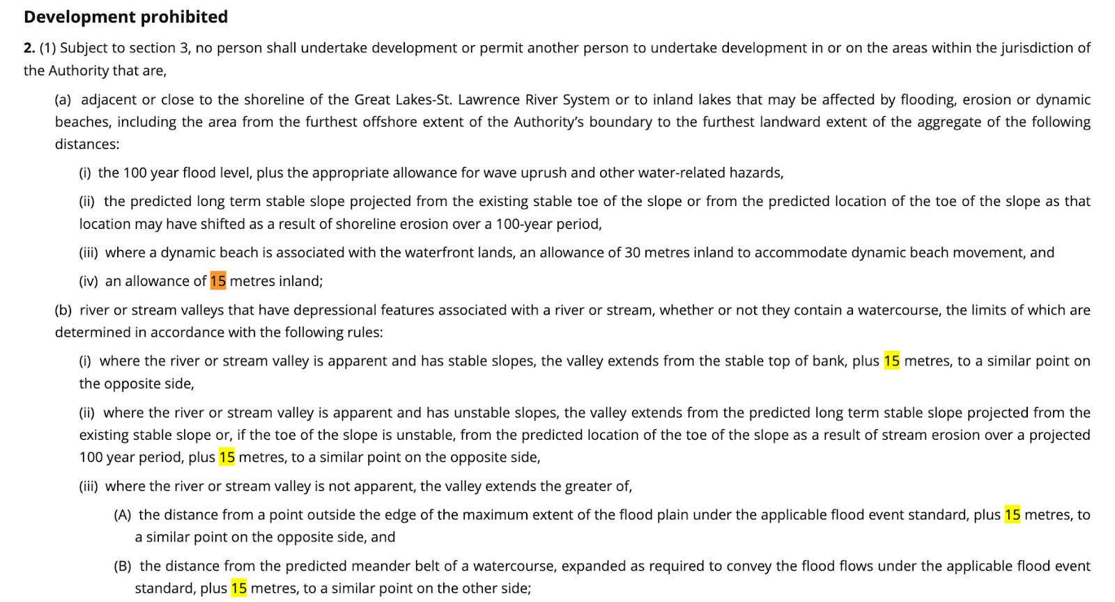

Before being revoked in 2024, Ontario’s Conservation Authorities regulations generally prohibited development within river valleys from the stable top of bank plus 15 metres and farther where slopes were unstable or projected to shift over a 100-year period. The protected area was intended to safeguard slope stability, prevent erosion and preserve ecological function along waterways.
(Government of Ontario)
Since Huttonville Forest is on the edge of the Credit River ravine, which drops down to the rushing waterway below, developers agreed to build at a height of 10 metres.
Labbé argued previously in her memo that Huttonville Forest, which is in close proximity to the valley trees, should be part of the preservation efforts, just like the buffering wall.
In order for Great Gulf to start building homes, the forest must be razed and the land levelled.
Behind Huttonville Public School, the developers have planned a stormwater management pond.
The report from SLR explained Great Gulf plans to cover the area next to the Provincially Significant Wetland (PSW) with "fill".
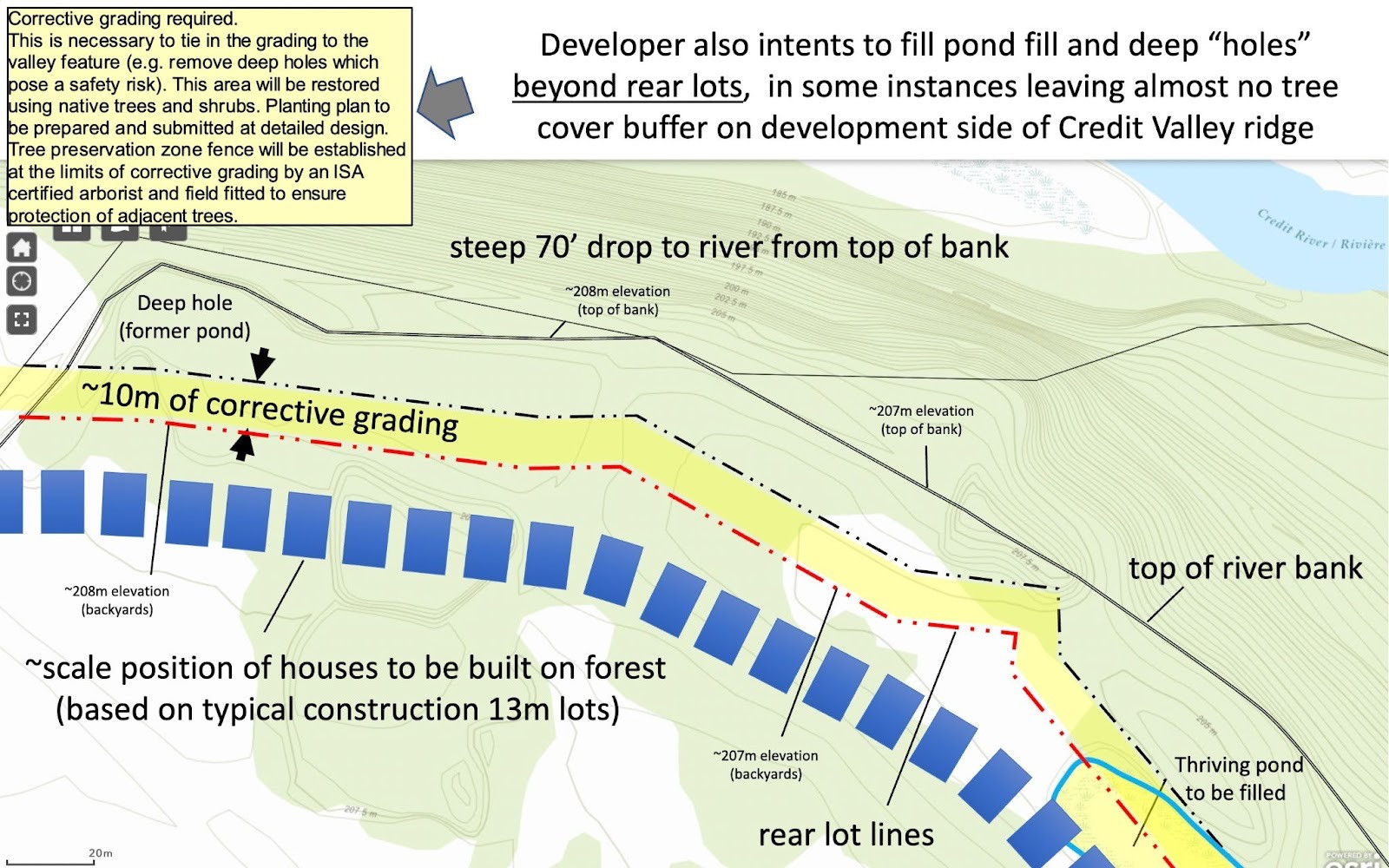
Brampton resident Ken MacDonald explained to prepare the site for residential development, a massive amount of fill (estimated at 50 or more truckloads) will need to be brought in to level the land including areas of the buffer that should remain untouched. MacDonald said the fill presents challenges due to its different soil composition and raises concerns about erosion. The buffer serves as the only corridor for wildlife including deer and coyotes to migrate along the river and filling it to match the subdivision threatens to squeeze and disrupt this vital habitat. With the forest gone, protecting the buffer has become the community’s primary concern.
(Submitted/Ken MacDonald)
But Labbé argued “the proposed (stormwater pond) will result in both short-term and long-term negative impacts to the integrity of the Credit River Valley, which is a Core Area in the Regional Greenland system”.
Her report stated the developers had "concluded" this was the only area for the pond.
Labbé advised that "offsetting the negative impacts" to the provincially protected area could be accomplished by preserving the Huttonville Forest since it is already a natural buffer.
Instead, developers decided to design the groundwater flow "around the pond to maintain water supply" for the Provincially Significant Wetland.
The buffer Labbé wanted would have been "situated to expand the naturalized area and buffer adjacent to the PSW."
Instead, Great Gulf cut down the Huttonville Forest, a thriving ecosystem that provides a buffer to a delicate wetland.
The CVC asked Great Gulf to clarify plans for the stormwater pond and its efforts to accommodate locally rare or protected species.
“Their job is to protect that zone no matter what,” Naylor emphasized.
He said it was determined that historic disturbance within portions of the buffer, dating back roughly 50 years, affected how the setback could be applied. Instead of preserving the entire area as it existed, regrading within parts of the zone was permitted, subject to restoration.
“They said they couldn’t preserve it, but they would restore it. That means the developer goes in, disturbs it and then plants it back,” he explained.
Naylor argued hundreds of trees within the buffer and adjacent forest were removed without being included in official compensation calculations.
“And if you don’t compensate for them, you’re effectively saying they had no value,” he added.
“You also can’t tear up the top of bank without impacting trees below it. Root systems extend well beyond that boundary. That impact wasn’t properly acknowledged.”
The fear is the grading could raise portions of land to create level building lots, potentially altering slope stability above the river valley.
Harlow has already observed that the slope is more fragile than it appears on paper.
“The hill is very steep right down to the river, so there are a lot of trees on the side of the hill, and we’re trying to make sure they don’t push overburden to fill in some of that natural slope,” she said.
“The ones that really bother me are these three beautiful old pines that are there. I’m so worried they’re going to kill or cut them down because they’re trying to get as close as they can.”
Naylor noted the remaining buffer could have been strengthened both ecologically and visually to soften the impact of development along the ridge by using dense native plantings to reinforce the slope and maintain habitat continuity.
Instead, he worries restoration might look like small saplings replacing decades-old trees that stabilized soil and provided habitat — “the absolute minimum the developer can get away with.”
The group is now seeking clarity from the City and CVC about how the setback width was determined and what oversight will govern the restoration plan.
In an email to MacDonald, Di Berto, senior manager of planning and policy at CVC, said the agency has not been involved with the project since 2022 and has not received any new submissions related to Phase 3 of the draft plan.
“The applicant is yet to submit the required plans in order to fulfil the conditions. We have not received anything related to Phase 3 and do not have the restoration or offsetting details…the developer is required to fulfil them to move along with the ultimate development of this site,” she wrote.
“As it relates to the pond and the current location of erosion and sediment control fencing, this is temporary in order to protect the site until such time earthworks will take place in accordance with the approved draft plan. We will receive those details once they are submitted at the time the developer is ready to proceed with the development of Phase 3.”
Once the developer submits the necessary plans, CVC and City staff will review them and restoration planting and ecological offsetting will be required prior to the City assuming the lands. The restoration process is administered by the municipality, she noted.
HNRA is now in process of finalizing a date to meet with City officials this month.
What HNRA was trying to achieve has been witnessed to play out west to Brampton. In Guelph, community outcry successfully pushed the City to reconsider the future of part of the former Kortright Waterfowl Park, a 20-acre field once slated for residential development.
Supporters had stressed the area is ecological significant and acts as a habitat buffer for wildlife and home to numerous bird and fish species.
On February 10, the City approved a motion to review the land’s designation as protected parkland while also working with the Grand River Conservation Authority to plan for trail restoration, future public access and long-term conservation of the surrounding Niska Road lands.
To Naylor, the forceful removal of nature in favour of unchecked development is not justifiable and more municipalities need to pay attention to our ever-changing green world.
“When you have to develop, every time you drop a woodlot, you have the environment, you force wildlife to move and to change and to leave. They have to find another place to go. That's just the way it works,” he said.
“It's the whole reason why conservation authorities exist. It is to recognize, to protect those habitats because we're running out of them. Every time a developer is able to get away with this, we further reduce the environment that we all rely on to survive and be part of the ecosystem.”
Email: [email protected]
At a time when vital public information is needed by everyone, The Pointer has taken down our paywall on all stories to ensure every resident of Brampton, Mississauga and Niagara has access to the facts. For those who are able, we encourage you to consider a subscription. This will help us report on important public interest issues the community needs to know about now more than ever. You can register for a 30-day free trial HERE. Thereafter, The Pointer will charge $10 a month and you can cancel any time right on the website. Thank you
Submit a correction about this story
