

Toronto and Region Conservation Authority assesses new role under PC government’s planning takeover
As Bill 23, the PC government’s plan to build 1.5 million homes by 2031, steamrolls into effect, the Toronto and Region Conservation Authority is outlining how it will adapt to legislative changes in the Conservation Authorities Act while trying to “enhance our region’s natural environment and protect our land, water and communities from the impacts of flooding and increasingly extreme weather events — Ontario’s leading cause of public emergencies.”
The developer-driven housing agenda adopted by the Doug Ford provincial government has been further exposed by recent scandals around Greenbelt land swaps, the takeover of municipal boundary expansions and the use of MZOs (Minister’s Zoning Orders) to override local jurisdiction over planning. One of the critical consequences of Ford’s determination to give sprawl developers what they want is the impact on conservation authorities. Ford’s PCs have forced the 36 CAs across Ontario to dramatically change their mandate, using three-dozen amendments in Bill 23 that strip away the ability of conservation authorities to guide future growth in a way that protects watersheds and their surrounding natural environment.
Through changes in legislation, the PC government has intentionally limited the ability of these guardians to have a say in future development projects.
When Bill 23 was pushed through the legislature in October 2022 by the PCs, it laid the groundwork for the development of 1.5 million homes across Ontario by 2031. Despite studies from experts and the government’s own housing affordability task force showing there is enough land within existing urban boundaries to build over 2 million homes, Bill 23 seeks to cut through some of the obstacles restricting rapid development.
The scandals have exposed the alarming way Ford’s PCs have approached land use, handing their powerful developer friends lands in the Greenbelt, pushing through bad planning by using MZOs, which supersede municipal decision making and are only supposed to be used in special circumstances, and taking over urban boundary expansions to benefit residential builders.
The erosion of conservation authorities was a necessary part of the plan to remove obstacles that protect the public, and Ontario’s natural spaces.
The vision of conservation authorities began to take shape in the 1940’s, but following the catastrophic impact of Hurricane Hazel, the provincial government amended the Conservation Authorities Act to provide these bodies with the power to acquire land for protection of surrounding areas. After 285 millimetres of rain fell in just 48 hours, the equivalent of 120,000 Olympic swimming pools, 81 people died. Legislators wanted to make sure next time, the province would be better prepared.
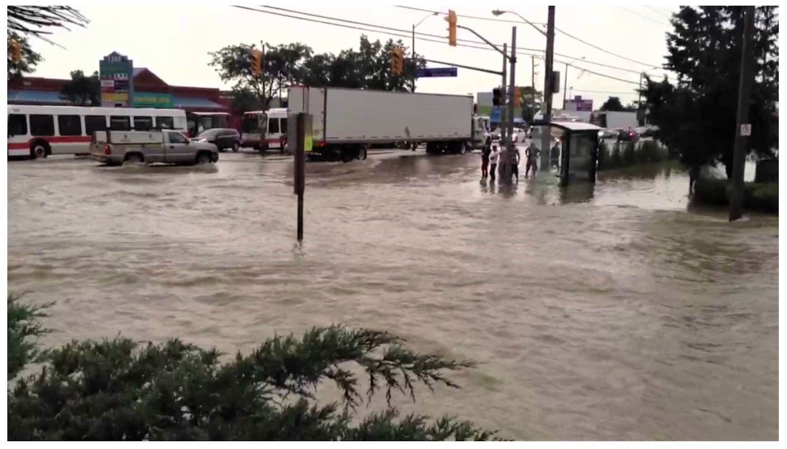
The 2013 flood washed out parts of the GTA, and was the costliest storm in Ontario history.
(Youtube)
In July 2013, stretches of Dundas Street East were suddenly transformed from a three-lane roadway to a rushing river, as 138 millimetres of rain fell in just 10 hours — a fifth of the average precipitation in the area over an entire year. Water gushed through low-lying basements as sump pumps backed up when the power went out from the storm. With $932 million in damages, it was the costliest storm in Ontario history.
Extreme weather events like Hurricane Hazel in 1954, and the devastating flood of 2013, are increasing in frequency and severity as atmospheric conditions have changed since human activity from the industrial age to today altered the chemical makeup of our oceans and airsheds.
The annual report by the U.S. National Oceanic and Atmospheric Administration showed the global average carbon dioxide content in the air was 417.06 parts per million in 2022 (the highest ever recorded), compared to about 315 in 1958. Prior to modern civilization and the start of human-produced atmospheric carbon, the rate fluctuated between 160 parts per million and 300 over the last 800,000 years, according to the NOAA.
The 1.5 degree temperature increase limit, compared to pre-industrial levels, set at the Paris Climate Agreement in 2015 has already been surpassed in parts of the world at certain times of the year and scientists have since warned that extreme weather events and major atmospheric changes will increase as countries fail to significantly reduce emissions. According to a study from Stanford University and the University of Colorado, researchers concluded, using artificial intelligence to predict warming timelines, the Earth is on track to surpass two-degrees of warming, with a 70 percent chance this will occur between 2044 and 2065, even with extreme emissions reductions.
At two degrees above pre-industrial levels, more than a quarter of the world’s population could endure an additional month of heat stress, oceans will become more acidic and warmer, and more than 70 percent of Earth’s coastlines will see a .2-metre rise, according to NASA. As temperature increases continue to play with the balance of the global weather system, severe storms will occur more frequently.
Southern Ontario is warming at twice the rate of the global average, meaning here, the impacts could be catastrophic.
Mississauga Councillor Stephen Dasko, who sits on the Board of Directors for both the TRCA and the Credit Valley Conservation Authority (CVC), said it is no longer just about mitigating the impacts of climate change, rather we must look at adapting our infrastructure and our communities to be able to withstand extreme weather events.
His concern with the PCs’ erosion of the conservation authority mandate is that there will be no authoritative body to focus on some of the environmental challenges when development projects are proposed. In some cases, a permit from the conservation authority will not be required for developments, and, when a permit is required, “conservation of land” and control of “pollution” are no longer suitable arguments to deny a permit under the new rules.
Where permission is no longer required from the conservation authority, it will most likely be the municipality that has to pick up the slack, but municipalities are being ignored by the heavy-handed planning tactics of the PCs, while their own planning resources are being scaled back, especially in Peel where the regional government will no longer exist by 2025.
“We want to make sure that everybody's all on the same page, and all working together on things,” he said.
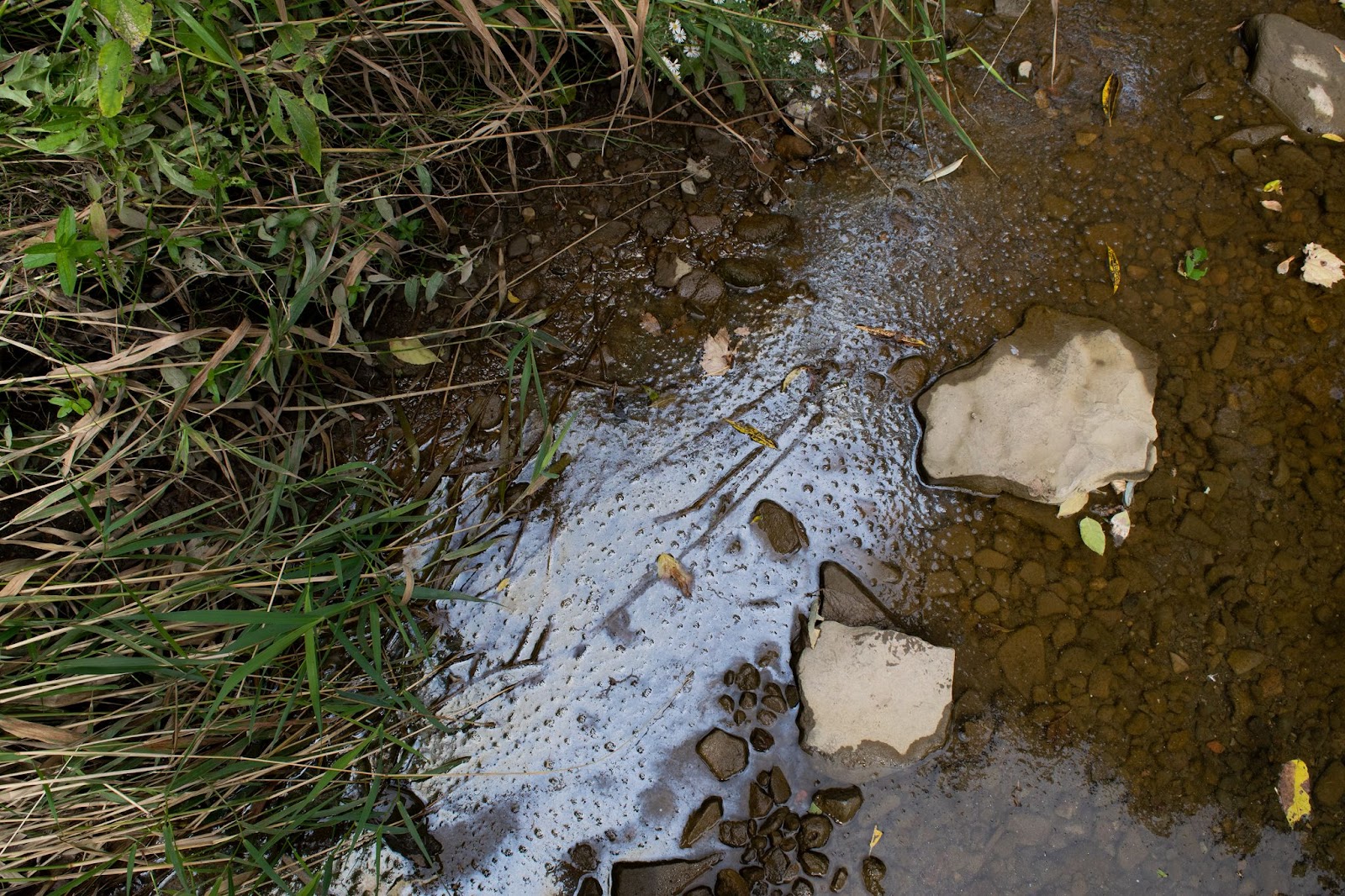
Conservation authorities are often known as water guardians, but Mississauga Councillor Stephen Dasko said some of their other roles, including education and outreach, are often overlooked or taken for granted.
(Alexis Wright/The Pointer)
One of the ways that conservation authorities can contribute to this collective knowledge is through education and outreach. Since these extensions are not impacted by Bill 23, it provides an opportunity for the agencies to expand knowledge to community stakeholders. The TRCA has increasingly been using outreach as a way to educate youth through programs such as the Minimum Access Standards, released in 2022, recommending to school boards a base level of education students should receive on topics involving nature, environmental health and sustainability.
The TRCA also runs the EcoSchools Canada program offering certification for elementary and high schools to focus on climate change education, specifically focussing on major current issues in environmental sustainability including wetlands, microplastics and urban-nature relationships. The TRCA provides education and training to teachers as well as overseeing field trips and outdoor education requirements.
“This is a cornerstone of what the TRCA and the other CAs do, because this is informing the public, but it's quite often informing a whole new generation to come,” Dasko said.
But education can also be provided on another level to community leaders and even elected officials who want to enhance sustainability within their own communities. Through the Sustainable Neighbourhood Action Program (SNAP) the TRCA and the CVC work with communities as partners to provide green energy and retrofits. Identifying these communities of concern is also a crucial step.
Currently, Dasko said he is seeing development applications proposed in areas of high concern, notably the Dundas Street corridor which poses an immense flood risk.
“I want to make sure that there's enough authority, that we can make good decisions, good long term decisions, so that people have a good footing of what's happened,” he said.
Conservation authorities provide programs and services in three categories with Category 1 being mandatory programs and services as outlined in provincial legislation, Category 2 includes activities the body agrees to on behalf of the municipality, and Category 3 being optional programs the organization feels are advisable to further the Act.
One thing that conservation authorities can still do that provides a critical resource for development is floodplain mapping. The TRCA is currently undertaking an update to its floodplain mapping which is legislated to be done every 10 years under the Conservation Authorities Act. The TRCA has noted the priorities of floodplain mapping are to “guide sensitive land use away from high risk areas; identify ways to mitigate flood risk where historical development has already occurred; and protect people, property, and the resilience of urban areas”.
The watershed plan for the Etobicoke Creek is estimated to be completed this year and a similar plan for the Humber River is also underway. These updates use new and enhanced technologies such as Lidar mapping which uses light reflection to understand surface and topography dynamics. The TRCA has previously noted that other radar technologies may become available that will further the ability to provide precise and effective mapping to predict future flooding events.
“Watershed planning provides a framework for establishing goals, objectives, and direction for the protection of water resources, the management of human activities, land, water, aquatic life, and resources within watersheds,” the TRCA previously told The Pointer in an email. “It also provides an opportunity for the assessment of cumulative, cross-jurisdictional, and cross-watershed impacts.”
Similarly, the Credit Valley Conservation Authority (CVC) is revamping its entire watershed plan, a feat that has not been mastered unilaterally in over 50 years.
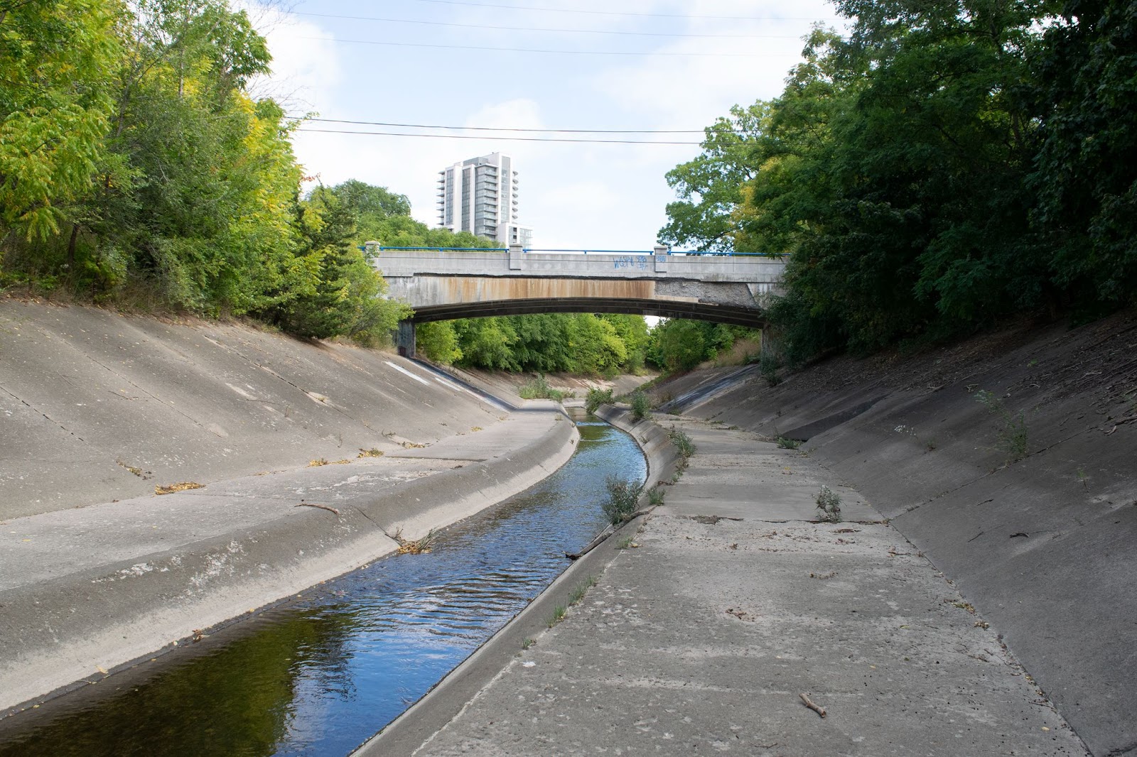
Phase 1 of Brampton’s Riverwalk project is expected to be completed in 2025.
(Alexis Wright/The Pointer)
Mapping has allowed for the development of projects like Riverwalk, a joint project with the TRCA and City of Brampton, designed to protect the downtown Brampton corridor from flooding in the Etobicoke Creek watershed. In 1952, a concrete bypass channel was constructed to divert the creek, which runs through downtown, to the east, which ultimately mitigated some of the damage from Hurricane Hazel two years later. But 31 hectares of Brampton’s core is still at risk for flooding from storm events. Phase 1 of the project will consist of widening and deepening of the channel to reduce flood risk while Phase 2 will involve the creation of parks and greenspaces surrounding the channel for a more sustainable ecosystem.
While watershed mapping is critical in identifying areas suitable for development, and has contributed to projects such as the Brampton Riverwalk, the provincial overhaul of the Wetland Evaluation System (WES) increases the availability of sensitive wetlands for development, putting infrastructure at risk while also contributing to the contamination of water sources.
Under the Bill, the majority of wetlands in southern Ontario would no longer be eligible for any sort of protection. Under the previous WES, the natural features were assessed on a scale of zero to 1,000 and a score of 600 or higher provided the designation of provincial significance, shielding it from development. Bill 23 changes the evaluation criteria, making it harder for wetlands to tally enough points for protection. Among the changes, the presence of endangered species no longer provides evaluation points to a wetland.
The amalgamation of smaller bodies of water is also no longer cause for protection. The previous legislation added the scores of these groups together as a wetland complex and if the entire complex scored over 600 they would be protected. Now each of these ponds or wetlands are set to be analyzed separately, eliminating the concept of a wetland complex, resulting in a large number of small wetlands vulnerable to development.
“With our watersheds, we need to not just protect them, but we also have to be respectful of them,” Dasko said. “Because no matter what people want to build, or whatever they want to do, nature is always going to win.”
Given the changes late in 2022, and the staggering implementation, the 2023 budget was largely unaffected. The TRCA receives the majority of its funding from municipal levies from the City of Toronto, Region of Peel, Durham Region, York Region and the Town of Mono.
According to a TRCA spokesperson, the 2024 budget has not been "significantly impacted" as a result of the changes from Bill 23.
“Conservation authority funding for plan review and commenting services on applications under the Planning Act and Environmental Assessment Act processes is on a cost recovery basis through TRCA Board approved fee schedules and is not provided through municipal budgets,” the statement reads. “Funding for the review and issuance of permit applications by TRCA under the Conservation Authorities Act is also on a cost recovery basis.”
It is also unclear whether or not the Memorandum of Understanding (MOU) between the municipalities and the conservation authority will be impacted.
Dasko said he would like to see more transparency from the province on how these changes will impact the roles and responsibilities of all community players.
“TRCA and CVC, and all of the conservation authorities will still be able to operate,” he said, noting successes like the joint TRCA, CVC and Region of Peel project creating the new Jim Tovey Conservation Area in Mississauga’s Lakeview community, spanning 26 hectares of land into a “green oasis”. “I think some clarity is also important going forward. Because you want to have that for not only the conservation authorities, but also the municipalities and those that are looking to interact or that have to interact with conservation authorities.”
Correction: A previous version of this story stated the TRCA did not respond to a request for comment. The article has been updated to reflect the organization's response.
Email: [email protected]
Twitter: @rachelnadia_
At a time when vital public information is needed by everyone, The Pointer has taken down our paywall on all stories to ensure every resident of Brampton, Mississauga and Niagara has access to the facts. For those who are able, we encourage you to consider a subscription. This will help us report on important public interest issues the community needs to know about now more than ever. You can register for a 30-day free trial HERE. Thereafter, The Pointer will charge $10 a month and you can cancel any time right on the website. Thank you
Submit a correction about this story
