
Decision time! Will Peel pave the way for a sprawling future or shift to walkable communities?
After years of planning and studies to show where and how Peel Region will grow until 2051, staff have recommended an approach to use more land outside the current urban boundary.
It has raised red flags for residents.
In 2022 the built out boundary is set for Mississauga, hemmed in by other cities and Lake Ontario. North Brampton still has large swaths of undeveloped space that currently bleed into rural Caledon at Mayfield Road.
In Caledon, which is geographically larger than Toronto with about three percent of its population, the biggest undeveloped area of the GTA, covered by agricultural properties and greenspaces, stretches from its southern border right up to the protected Greenbelt that runs across the top half of the massive municipality. Some already sparsely populated hamlets and villages dot the landscape but outside the major suburban area of Bolton there is little infrastructure to support the hundreds of thousands of residents who will flood in over the next few decades.
Land use issues and growth pressures have defined the divisive controversies that have shaped Caledon’s discourse for two decades.
Local elected officials have even admitted the lure of huge profits has influenced their thinking around how Caledon’s land should be used in the future.
In 2004, former Caledon councillor Nancy Stewart spoke to In The Hills magazine. Her family had been farming in Caledon for 150 years and she talked candidly about what the new provincial Greenbelt legislation being introduced at the time, preventing any development in the protected area, would mean. “Aging farmers need to cash out their pension plans. They must sell their farms.” She said farmers wanted to sell their land to developers as more and more homebuyers desired the types of sprawling subdivisions that had already been built across the rest of Peel. But she was concerned for those who owned property inside the area that would soon be protected. “We should be helping the farmers get the hell out of it and get their money.”
Caledon has been torn ever since over how its municipal boundary should be determined, and what type of growth should be shaped.
Other than a tiny area of Bolton, it’s not walkable for anyone trying to access services and commercial offerings. Using a car is the only way to get around.
With 700,000 additional residents expected to settle in Peel over the next three decades, how will Caledon and other parts of the region grow from here?
Will it be more of the costly, spread out subdivisions that heavily tax property owners who are forced to pay for sprawling infrastructure and municipal services in a suburban built form reliant on the car?
Or will this current group of councillors follow the lead of Hamilton and Halton, where elected officials rejected urban boundary expansion, opting instead to accommodate future growth in more complete communities, where public transportation can be supported and more sustainable ways of living will help address the climate emergency?
The future of Caledon, and for Peel taxpayers, is currently being determined through a massive planning exercise.
Through the province’s ongoing Municipal Comprehensive Review (MCR) Peel planning staff have made a recommendation to Regional Council to expand the urban boundary out from Brampton, across Mayfield Road and up and over to Bolton; 4,400 hectares (almost 11,000 acres), to accommodate many of the 700,000 new residents and 335,000 new employees expected to live and work in Peel by 2051.
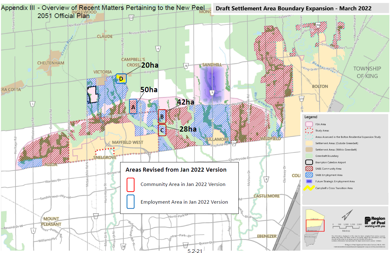
The areas proposed to be opened up for development in Peel are shaded in red and blue.
(Region of Peel)
Staff have said three scenarios have been considered: no urban boundary expansion with all of the future growth to 2051 accommodated in the existing area, which still has 5,600 hectares (almost 14,000 acres) of undeveloped land for community and employment growth; a market-driven urban boundary expansion with 5,900 hectares (almost 14,600 acres) for “community” growth alone (not including land for future employment); and a “balanced” approach with about 4,400 hectares (almost 11,000 acres) for community and employment growth out to 2051.
Staff have recommended the balanced approach in the middle, which represents, according to their calculations, a 55 percent intensification rate, compared to an intensification rate of 75 percent that would be achieved if the urban boundary is not expanded.
It’s unclear if the almost 11,000 acres of additional land, on top of the almost 14,000 acres of undeveloped land in the existing urban boundary would allow for the types of densities needed to create complete communities with much more transit use instead of the car.
In justifying the less dense option that will require much more land for larger sprawling homes, staff said, “The Region is required by Provincial policy to consider the [housing] market in our Official Plan review. Through the Region’s Official Plan Review we considered a number of factors that needed to be balanced in addition to market demands. So even with the expansion to the settlement boundary the market demands are not fully met.”
Staff emphasize there is no possible way to accommodate future population and jobs within the current urban boundary while also appeasing those in the housing market who do not want to live in denser complete communities that feature high-rise condos and apartments, mid-rises, townhomes and rowhouses.
Unlike the ultimate decision of elected officials in Hamilton and Halton, staff in Peel’s planning department continue to oppose the idea that the region could accommodate 700,000 residents and 335,000 employees within the current urban boundary.
They believe the housing market in Peel would be undesirable for many and the gentle intensification planners are trying to achieve would not be possible.
The Region knows it has to create much more dense neighbourhoods to reach its own emissions reduction targets, to create more public transit and the 15-minute communities desired by so many.
But critics say the recommendation to open up almost 11,000 additional acres is being driven by developer interests and those elected officials who are beholden to these private companies that have funded their careers.
“It’s no coincidence that the OP [Official Plan] mirrors the line of Highway 413,” Jenni Le Forestier, member of Stop Sprawl Peel, said on The Pointer’s What’s The Point podcast. “So the push for these OPs, and the push for these municipalities to sprawl is definitely tied to the highway… it is the height of hypocrisy to say that you don’t support the 413, but then to support an OP that directly mirrors the highway.”
Regional Council voted against the construction of Highway 413, also known as the GTA West Highway but councillors such as regional planning chair Carolyn Parrish, who signalled last week that she will support the staff recommendation to expand the urban boundary, seem out of step with their own claims of wanting to protect the local environment.
The Pointer asked staff about the similarity between the recommended areas for the urban boundary expansion and the approved route for the 413, which would spring far more sprawling development compared to planning for complete communities around already built up areas such as Bolton.
“We are required by the Province to protect for the GTA West Highway which is why you see the outline of the corridor on the map, however all technical studies were re-assessed after Council passed a resolution opposing the GTA West Highway to identify a settlement expansion area and employment lands within it that will be successful with or without a highway,” a Regional planner told The Pointer in an email.
It’s unclear why planning would have to ensure development along the highway corridor if it never gets built, instead of changing course to a much more dense, complete community approach that could be pursued in areas that are not near the proposed highway corridor, and represent the opportunity to move away from sprawling highway subdivision design.
It was pointed out to staff that the proposed urban boundary expansion, which mirrors the approved highway corridor, also mirrors where developers have already bought up large swaths of farmland, hoping to make huge profits from turning the properties into subdivision housing, the so-called market-driven supply so many buyers want.
Critics have said the highway, and now the urban boundary expansion, have been driven by the subdivision development industry that wants growth to be placed exactly where they speculated on land, not where it should go to ensure more sustainable communities that won’t cost property taxpayers large sums. Running municipal services and infrastructure to far flung places is also a recipe for financial hardship within local governments, as all three lower tier municipalities and Peel Region will have to find revenues to pay for expensive sprawl.
Taxes raised per hectare served by each municipality are much higher when more density is approved for each parcel of land. One mid-rise condo with 20 units not only generates far more money for the municipality than five homes on the same footprint, the cost to service denser areas next to existing infrastructure that does not have to be extended out to isolated areas, is far less.
Ultimately, elected officials will decide if they want to accept the staff recommendation. The Regional Council meeting is set for Thursday.
Local environmental advocates want planners to consider the impact their recommendation—to develop almost 11,000 more acres—will have on climate change.
“A climate change lens has been developed to support the evaluation of scenarios and assist with the Growth Management and Settlement Area Boundary Expansion (SABE),” staff told The Pointer. It’s unclear how a “climate change lens” was used and why staff still recommended almost 11,000 acres be opened up, which advocates have shown will have a devastating impact on the local environment while contributing to significant increases in carbon emissions that contradict the Region’s commitments to address climate change.
Peel advocates want no urban boundary expansion like the decision by nearby Halton Region Council and City of Hamilton Council. Both of these municipalities’ staff recommendations supported expansion of the urban boundary, but the two councils voted to keep the land untouched.
Jane Fogal, a Region of Halton Councillor voted against the staff recommendation there because she is worried about planning policies that don’t align with climate change best practices.
“I'm very much concerned with climate change, it's on my mind, a lot,” she told The Pointer. “We declare a climate emergency, and the emergency is more clear every day.”
For her, there is a direct correlation between sprawling houses and greenhouse gas emissions. She firmly believes in order for Halton to achieve its net zero emissions target by 2030, the Region has to stop allowing land to be designated to single detached houses.
“We have the best farmland there is,” Councillor Fogal said. “And partly, it's so great because it is flat, and flat means that's where the developers want to go. But they're not making more soil. So it seems to me that it's precious.”
What drives the MCR and staff’s overall recommendation is the Growth Plan for the Greater Golden Horseshoe (GGH) and the Planning Act, two pieces of legislation that force municipalities to use specific methodologies when planning for growth.
There are two key processes staff were required to undertake, the Land Needs Assessment (LNA) which later draws conclusions for a Settlement Area Boundary Expansion (SABE).
Ontario laid out all the growth requirements for municipal planners in the Growth Plan, which was updated in 2020. It tells Peel a minimum of 50 percent of all residential development per year must occur within urban areas, this is known as the minimum intensification rate.
This is calculated by, “applying the number of housing units built within [a time frame] within the built-up area, divided by the total number of housing units built in Peel between the same time period.”
Phil Pothen, Ontario Environmental Program Manager at Environmental Defence, explained the intensification rate is often misinterpreted by members of the public.
“It doesn't mean that existing neighborhoods will become 75 percent more dense… All it means is that 75 percent of growth would go to existing neighbourhoods,” Pothen told The Pointer.
In designated greenfield areas (DGA), which is land within the current urban boundary available for development, new projects must support complete communities, have active transportation networks and encourage integration of new transportation methods. Peel currently has 5,600 hectares (13,837 acres) of land within the current boundary that either is untouched or in the planned status. These sites have a minimum density target of 50 residents and jobs (p/j) per hectare.
Pothen believes the Region can accommodate future housing mix and jobs within the existing urban boundary without a need for expansion.
“The current draft plan, which Council is being asked to approve would leave that [greenfield] land zoned for population and job densities that are far less than the bare minimum 90 to 100 people per hectare, that are needed to support cost effective transit and amenities within walking distance,” Pothen said.
The additional land being recommended will almost certainly be used for the same type of sprawl that has dominated the GTA since the ‘80s.
To him the first step in a new direction would be to increase the DGA densities, allowing for further growth within the existing urban boundary to be accommodated. According to the Regional Official Plan, the people/jobs per hectare density of these areas is 65 people/jobs per hectare, a figure that represents car-centric suburban patterns of development.
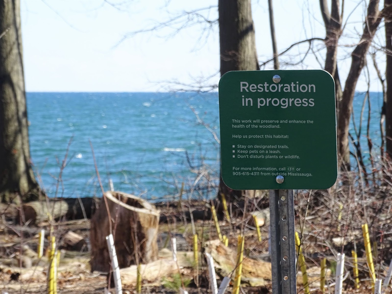
Cities and the Region have been attempting to repair fractured ecosystemes decimated by urban sprawl.
(Natasha O’Neill/ The Pointer)
The almost 11,000 acres of expansion staff are recommending would be greenfield development.
“It's astounding that sprawl proponents in the town of Caledon are asking for even more greenfield land, when countless existing neighborhoods, like much of Caledon East, have only achieved a 15 or 20 people per hectare density, which is less than 1/5 of the densities that they need to be complete communities,” Pothen said.
Urban growth centres, like Downtown Mississauga and Brampton, must have a density of at least 200 residents and jobs combined per hectare.
According to the Growth Plan, municipalities are “encouraged to go beyond these minimum standards,” unless it would conflict with other aspects of the plan. Both Halton and Hamilton adopted Official Plans that have a higher intensification rate (80 percent each), to which the Minister of Municipal Affairs and Housing, Steve Clark, responded, saying it is an “unrealistic” and “irresponsible” way to plan. His PC government has made it clear that complete community planning, with funding for public transportation, is not a priority. The PCs have introduced legislation throughout this term to benefit subdivision developers instead.
It flies in the face of The Growth Plan which adds emphasis on intensification of built-up urban areas, which is a good thing for residents wanting a walkable community. It also says municipalities must, “accommodate all housing market segments; avoid housing shortages; consider market demand...”.
In response to how the LNA is conducted, Regional staff wrote in a October 2021 report, “the market-based approach is primarily determined by considering historic trends in housing.”
Staff determined there was a “historic preference” for single and semi detached homes over apartments and other more dense forms of housing.
In order for staff to comply with provincial legislation and accommodate the housing market, they must use historic data to determine future needs, a backward approach forcing cities to look to the past, not the future.
The purpose of that methodology is very clear and favours an expanded urban boundary approach.
It handcuffs planners into determining, “the total quantity of land needed to accommodate forecasted growth to the Plan horizon” leading ultimately to a SABE when land within the boundary cannot accommodate larger single detached homes.
“While it may be necessary to adjust the housing projection in this analysis to meet the Plan targets, providing a market-based supply of housing while conforming to the Plan is an objective,” the Growth Plan states.
Peel Region was officially formed in 1974. Geographically located beside densely populated Toronto, Peel’s cities were marketed as “the suburban dream.” Low rise sprawl was encouraged and appealed to residents hoping to settle down on quiet streets, with larger properties.
Many who grew up in the suburbs now want to recreate the same type of lifestyle as they think of buying their own home.
Others want to live in a much more urban environment, one conducive to modern lifestyles and concerns over climate change.
If Peel were to accommodate the 700,000 people and 335,000 jobs by 2051 within the existing urban boundary the intensification rate would be 75 percent according to staff. This would encourage council to invest more in public transportation, urban infrastructure and amend height and severance restrictions to accommodate infill density.
This would force development upward not outward.
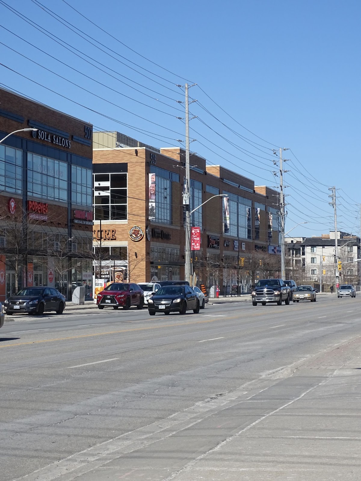
Lakeshore Road East has been the site of debate between residents and developers in the plan for the area’s future.
(Natasha O’Neill/The Pointer)
But Peel staff claim this is not what the “market” wants.
“The substantial mismatch between household needs and planned housing supply would cause increased housing affordability challenges and could result in ‘leapfrogging’ as households seek to meet their housing needs in more distant communities,” Regional staff wrote in their recommendation report.
Halton’s Councillor Fogal, says the housing stock in any municipality is mostly single detached housing, which is more than enough to appease the residents who do want a sprawling home.
“In the end, it's location, location, location. If you build a community that is interesting, safe, exciting, and walkable, people will want to live there,” she says. “There will be some people that don't, but there will be other people that do. It's not really a problem in my mind.”
Having a complete community means residents are able to live, work and play within a 15-minute walk. This cannot be accomplished under the density that would be created if the urban boundary is expanded, pushing people farther away, not closer together.
Pothen believes Peel should be using existing industrial areas and other low-density corridors inside the current urban boundary and focus on intensifying these areas instead of expanding.
“It is really unconscionable that the current 2051 draft official plan continues to plan industrial land, on the basis that factories, warehouses and distribution centres are going to be limited to a couple of storeys.”
According to Pothen, across the world cities are transforming large warehouses into high density employment areas, by adding more storeys on existing buildings.
Peel’s two large cities, Brampton and Mississauga, say they want to shift away from low density industrial employment, in favour of white-collar, technology, finance and other types of professional employment in our knowledge based economy. To Pothen, it is difficult to understand why the Region would continue to open land for development if Peel cities are trying to shift away from low density, low return land consuming industries like trucking and warehousing.
On Thursday, Regional Council will discuss the staff recommendation to expand the urban boundary.
Councillor Fogal hopes Peel’s elected members think about the other municipalities and the bigger picture.
“We are all in this together. The agricultural system goes across all these boundaries, climate change goes across all boundaries. We need them all to be thinking that way”.
Pothen wants to hit the pause button.
“Every councillor should be voting to defer consideration of this draft official plan until after the election, when we know what the post election policy environment is going to be,” he said.
For now, the decision rests on the shoulders of the 24 elected members of Peel Region’s government, who will be representing not only the wishes of 1.6 million current residents, but the 700,000 people who will soon settle in the region.
Will it transition to a modern urban centre, or cement its status as Canada’s largest suburb?
Email: [email protected]
Twitter: @taasha__15
COVID-19 is impacting all Canadians. At a time when vital public information is needed by everyone, The Pointer has taken down our paywall on all stories relating to the pandemic and those of public interest to ensure every resident of Brampton and Mississauga has access to the facts. For those who are able, we encourage you to consider a subscription. This will help us report on important public interest issues the community needs to know about now more than ever. You can register for a 30-day free trial HERE. Thereafter, The Pointer will charge $10 a month and you can cancel any time right on the website. Thank you
Submit a correction about this story
