
A group of conservation authorities are turning to nature to protect Lake Ontario’s future
The expansive Lake Ontario shoreline is more than just a beautiful stretch of land. It’s a vital resource for millions of people and species of wildlife, and it’s under increasing strain as climate change and relentless coastal erosion threaten its stability and the communities that depend on it.
Home to 25 percent of Canada’s population, the lake’s waters and surrounding wetlands provide drinking water, habitats for wildlife and fish and critical economic opportunities.
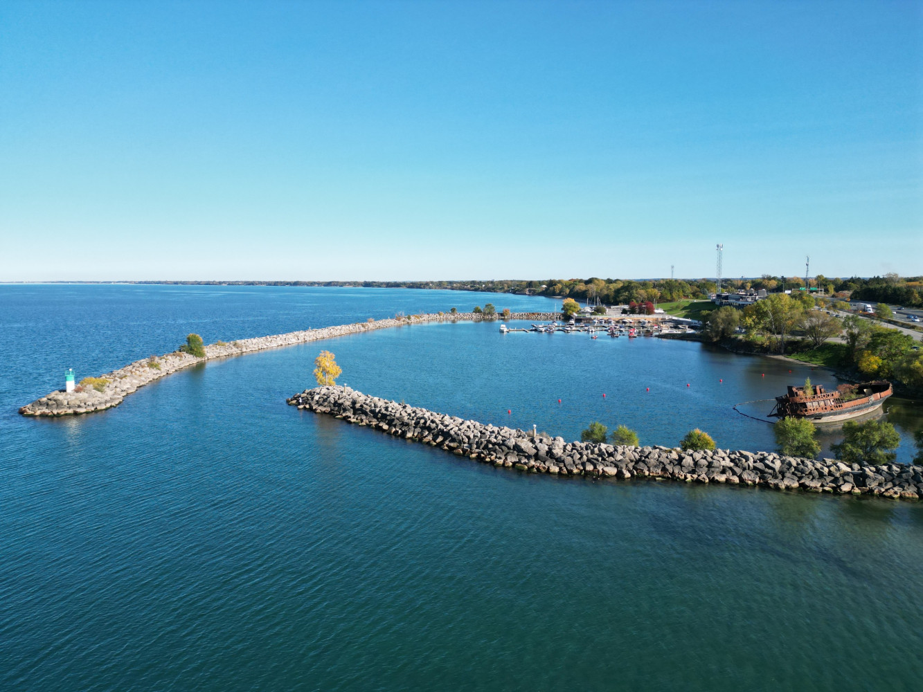
Over half of Lake Ontario’s shoreline in the Niagara Peninsula and adjacent areas is fortified with hard infrastructure, including concrete revetments, armour stones, and rock barriers, designed to halt the gradual loss of land to water. These structures, once seen as protective measures, are now crumbling, eroding, or failing. The consequences are expensive repairs, environmental degradation and increased risk to homes, businesses and municipal infrastructure.
Niagara Peninsula Conservation Authority’s Chief Administrative Officer, Leilani Lee-Yates, says these challenges don’t exist in isolation, and the solutions shouldn’t either.
On July 22, the Niagara Peninsula Conservation Authority (NPCA), in collaboration with Conservation Halton (CH), Hamilton Conservation Authority (HCA), Conservation Ontario (CO), and the Great Lakes and St. Lawrence Cities Initiative, officially launched the Lake Ontario Coastal Resilience Pilot Project. Together, the three conservation authorities aim to address these challenges, for the next four years, through a science-based, cooperative approach, bringing together multiple stakeholders, including Indigenous and municipal leaders, conservation authorities, and local communities, to develop sustainable, nature-based solutions for the region.
“We realized we needed a coordinated, science-based approach,” Lee-Yates told The Pointer.
“This project came out of ongoing discussions with other conservation authorities and Conservation Ontario. We were all seeing similar impacts along the Great Lakes shoreline, flooding, erosion, fluctuating water levels, storm surges, and we began talking about the need for collective action…we also wanted to better understand how climate change may be affecting those impacts.”
Traditionally, conservation authorities have managed shoreline hazards through regulatory mapping and shoreline management plans, much like they do for riverine floodplains. But Lee-Yates says climate change is now reshaping those risk profiles, demanding updated, science-driven tools and more collaborative solutions.
She explains that the teams will be looking at not just the physical hazards, but also the impact on infrastructure, ecosystems and even socioeconomic factors.

Living along the coast brings its share of challenges, particularly as strong winds, storm surges, and extreme weather events intensify coastal hazards like erosion and flooding. These phenomena lead to costly damage to homes, businesses, and critical infrastructure, with climate change only magnifying the risks. Unprecedented weather events are exacerbating these coastal threats, increasing damage to infrastructure and triggering significant financial losses in the region. Erosion, in particular, is a growing concern, with rill and gully erosion posing different levels of severity. While rills are small, shallow channels easily removed by tillage, gullies are much larger and deeper, often resistant to traditional agricultural methods. Both types of erosion threaten the stability of the landscape, but gullies, due to their scale, represent a much more serious risk.
(Conservation Ontario)
As reported by The Pointer, the Great Lakes are already grappling with the pressures of climate-induced changes; controversial projects like the redevelopment of Ontario Place and the construction of Highway 413, promoted by Premier Doug Ford's PC government, which threaten to further strain on an already fragile ecosystem.

The Niagara Peninsula watershed, encompassing 2,424 square kilometres and serving around 520,000 people, is a unique and ecologically rich area of North America. Nestled in the Carolinian life zone, this region is home to a remarkable array of natural features, including forests, wetlands, alvars and coastal habitats, which support more than 2,200 species of plants and animals. However, the watershed faces significant challenges. While 28 percent of the land remains in some form of natural cover, much of its once-abundant wetland areas have been lost, making it the region with the highest wetland loss in Ontario. Nearly 10 percent of the species within the watershed are rare or at risk, primarily due to urban sprawl, invasive species, pollution, and the impacts of climate change. With over 93 percent of the land privately owned, the preservation of this biodiversity is a shared responsibility that requires concerted conservation efforts across the entire community.
(NPCA Watershed report card 2023)
The five Great Lakes, holding 21 percent of the world’s surface freshwater and 84 percent of North America’s, are not only vital for ecosystems but also a significant economic force, supporting over 50 million jobs and contributing a staggering $6 trillion to the global Gross Domestic Product (GDP), according to the World Economic Forum.
In Ontario, the Great Lakes drive 91 percent of the provincial GDP, equivalent to roughly 35 percent of Canada’s total, with Lake Ontario standing as the key economic engine, contributing 68 percent of the province’s GDP, a 2020 University of Waterloo study notes.
Protecting the environment is crucial, not just for future generations, but for the economy today. Nature-based solutions are an essential piece of this effort, offering a sustainable way forward.
In Niagara, the town of Pelham is leading the way by collaborating with the Greenbelt Foundation and the Natural Assets Initiative (NAI) on the Pelham Greenbelt Natural Asset Management Project. It focuses on identifying, measuring, and valuing the town’s natural assets, like forests, wetlands, and watersheds and integrating them into Pelham’s core infrastructure, ensuring their preservation and long-term benefits for both the environment and the community.
The natural assets in Pelham are valued at over $585 million, offering stormwater management and flood control services that would otherwise cost the town millions to replace with traditional infrastructure. By protecting these natural systems, Pelham is not only safeguarding its environment but also saving money while boosting resilience.
“Pelham is proud to be a leader in including natural infrastructure as part of our asset management plan,” Mayor Marvin Junkin said. “With the success of this project, we hope that other municipalities will follow our example and find ways to preserve and protect natural infrastructure assets within their boundaries.”

The Lake Ontario Basin is a critical part of the province’s southern ecosystems. A network of water courses that run down from the Greenbelt makes Brampton and Mississauga prone to flooding.
(Michigan Sea Grant)
Lee-Yates explained that the project will involve risk and vulnerability assessments along the shoreline, with a focus on identifying potential hazards and testing mitigation or remediation strategies. It will explore a wide range of solutions, from nature-based approaches like creating coastal wetlands or enhancing beach dunes, to hybrid methods that combine traditional infrastructure, such as revetments, with natural solutions.
When asked whether the study would provide insight into investment needs, Lee-Yates emphasized that the project aims to give an initial sense of potential costs.
“We’ll be looking at case studies to estimate costs associated with these solutions,” she said. “This will provide a starting point for landowners, municipalities, and business owners, giving them a clearer picture of what investments may be required, but we recognize that further work will be needed to assess the full costs if these solutions are implemented long-term.”
She sees the project as the first step in a much broader process. "This study will offer some early insights into the costs, but for anyone looking to move forward with these solutions, additional work will be necessary to evaluate the full scope of investments required.”
The Lake Ontario Coastal Resilience Pilot Project is more than just a local effort; it is a key part of a national strategy to address the escalating challenges faced by communities around the Great Lakes.

In 2024, the Canadian Federal Government launched the four-year Climate-Resilient Coastal Communities (CRCC) program, allocating $4.1 million for pilot projects across the Great Lakes region to tackle the disproportionate impacts of climate change on coastal communities. One such initiative, Adapting to Coastal Hazards Across the Great Lakes, led by Conservation Ontario, partners with conservation authorities to implement three pilot projects in Northern Lake Superior, Southern Lake Huron, and Western Lake Ontario which will assess the social, environmental, and economic impacts of coastal hazards, and engage municipal, business, community, and Indigenous groups. The effort also strengthens Conservation Ontario's capacity to support the Conservation Authority Coastal Network in addressing these challenges region-wide.
Backed by a $3.1 million investment from the Government of Canada through Natural Resources Canada’s Climate-Resilient Coastal Communities (CRCC) Program, the pilot project is one of only three Great Lakes initiatives to receive $1.5 million in funding and aims to set a precedent for regional collaboration in the fight against climate change.
By 2027, the Development of Resilience Plan will be completed, along with ongoing community engagement, including policy recommendations and an actionable implementation roadmap.
The NPCA is in the process of creating an engagement plan, featuring a dedicated page on the "Get Involved" portal, which will allow residents to provide feedback via information centers, online surveys, and direct communication with the project team. Throughout the project, draft maps and documents will be shared online, ensuring the community remains informed and actively involved in the process.
Email: [email protected]
At a time when vital public information is needed by everyone, The Pointer has taken down our paywall on all stories to ensure every resident of Brampton, Mississauga and Niagara has access to the facts. For those who are able, we encourage you to consider a subscription. This will help us report on important public interest issues the community needs to know about now more than ever. You can register for a 30-day free trial HERE. Thereafter, The Pointer will charge $10 a month and you can cancel any time right on the website. Thank you
Submit a correction about this story
