
Brampton reflects on damaging Churchville flood while PCs make it easier to build in floodplains
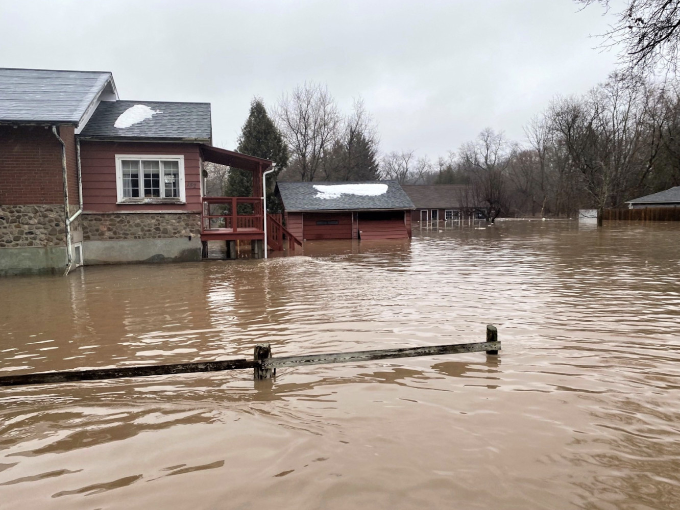
In February 2022, an early spring thaw became devastating for Brampton’s historic Churchville neighbourhood when the swollen Credit River spilled its banks and submerged the community under six feet of water.
Approximately 50 homes were evacuated and 15 to 20 were damaged as 35 to 45 millimeters of rain fell. The rainwater, mixed with melting snow and mild temperatures caused the ice covering the Credit River to crack and break up. As the ice flowed down the river, it created a blockage in a bend just downstream of the Churchville Road bridge. Water levels rose quickly, backing up through sewer systems and overflowing into the existing floodplain.
Just over a year later, the City of Brampton and the Credit Valley Conservation Authority (CVC) are reflecting on the calamity, determining that one of the key factors for the devastation was that the neighbourhood was built in a legacy floodplain. While conservation authorities and urban planners alike caution of building in floodplains for its increased risk of flooding and for the impacts on the environment — greater concentration of debris and chemicals in runoff — the Ford government is increasingly making it easier for developers to build in these sensitive areas and has taken little action on education for those who live in floodplains.
Churchville is located along the Credit River between Steeles Avenue and Highway 407. The neighbourhood was originally founded in 1815 when the river was used advantageously to build a mill and, subsequently, a bustling community. But continued development in the area placed family homes in an active floodplain.
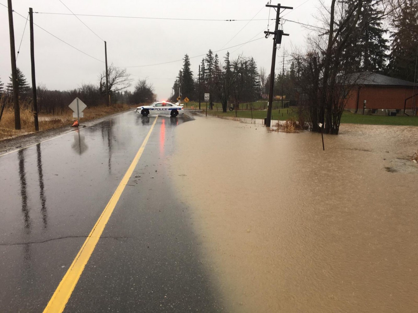
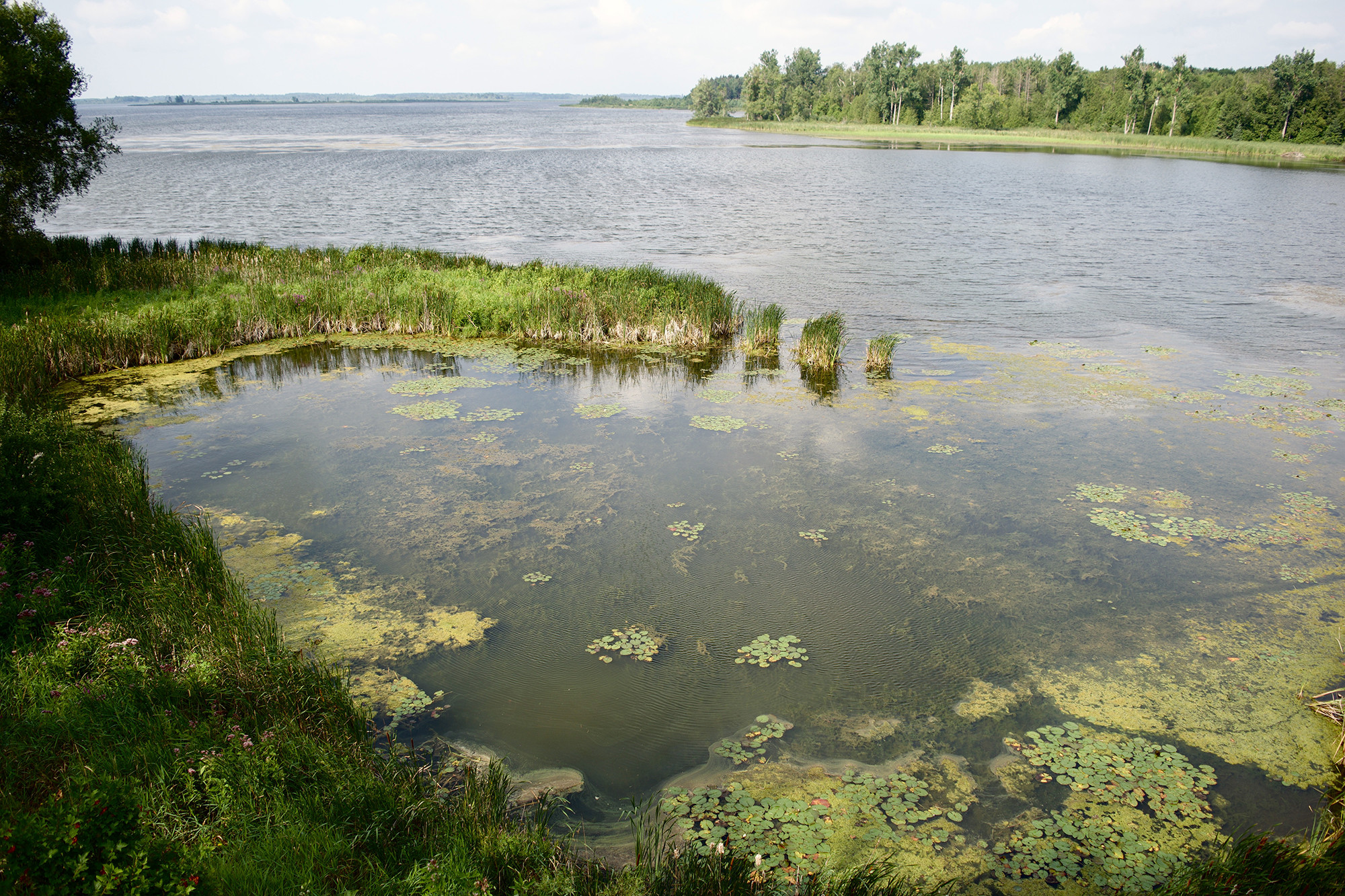
Many areas of Peel are vulnerable to flooding, posing difficult questions for municipalities tasked with maintaining infrastructure designed to protect communities.
(Peel Regional Police)
The low-lying lands on which the Churchville neighbourhood sits are extremely flood prone, with at least 34 flooding events occurring in the century between 1922 and 2022. After a particularly damaging flood in 1987, the CVC undertook the Churchville Flood Control Project which led to the installation of berms — ridges of compacted soil, gravel or stone that diverts water to a controlled drainage outlet — to mitigate future flood risk.
In 2006, a new storm sewer was also installed on one of the neighbourhood’s main streets to drain a new subdivision on the north end of the community down to the Credit River. A system of gates were installed to prevent high water levels backing up in the sewers from the Credit and into the neighbourhood. In 2010, the Region of Peel updated the flap gate just north of the Churchville Road bridge during a sanitary sewer project.
Despite these additional standards, Churchville was still drowned last February, causing the City and the CVC to review the factors that led to the flood and evaluate potential mitigation measures.
One of the major factors leading to the 2022 flood was the ice jamming that occurred in the river’s elbow. According to the City staff report, this is the primary cause of the majority of floods that have happened in the neighbourhood over the last century.
In the absence of the ice jams that occurred, peak water levels across the majority of the Credit River in February 2022 were equivalent to that of a one in 10 year flood event which would not cause flooding in the adjacent neighbourhood. But because of ice jamming, the water levels surged to those similar to a one in 100 year flood event.
Both Brampton and the CVC responded immediately to the ice jam, according to the City. The quick response helped to ensure that there were no injuries amongst residents, City staff or contractors working on site.
The CVC listed three lessons learned from its response to the ice jam. The first is that it is impossible to predict when an ice jam will occur. However, the CVC works diligently to predict when weather conditions are ideal for river ice to break up. While it may be impossible to accurately predict an ice jam, the CVC continues to monitor the river.
“Ongoing field monitoring of conditions using flow gauges and by patrol staff is important,” the report states.
One type of intervention that can occur for an ice jam in orde to prevent flooding is to use blasting to break it up before water levels rise too high. However, there are limitations to when blasting can be used. The act of blasting typically needs to happen as soon as possible to ensure that there is sufficient flow behind it to push the sometimes massive chunks of ice downriver. In most cases, the larger the timeframe between when the ice jam first occurred and when blasting is implemented, the greater risk there is to workers. The CVC has not employed blasting contractors since the 1990s due to changes in mandate and typically by the time the CVC can secure an independent contractors, it’s too late to do any blasting.
The CVC also noted that blasting can lead to problems further downstream which was considered in the case of Churchville.
“City staff elected not to blast this ice jam but it was considered as a ‘last resort’ option,” the staff report states.
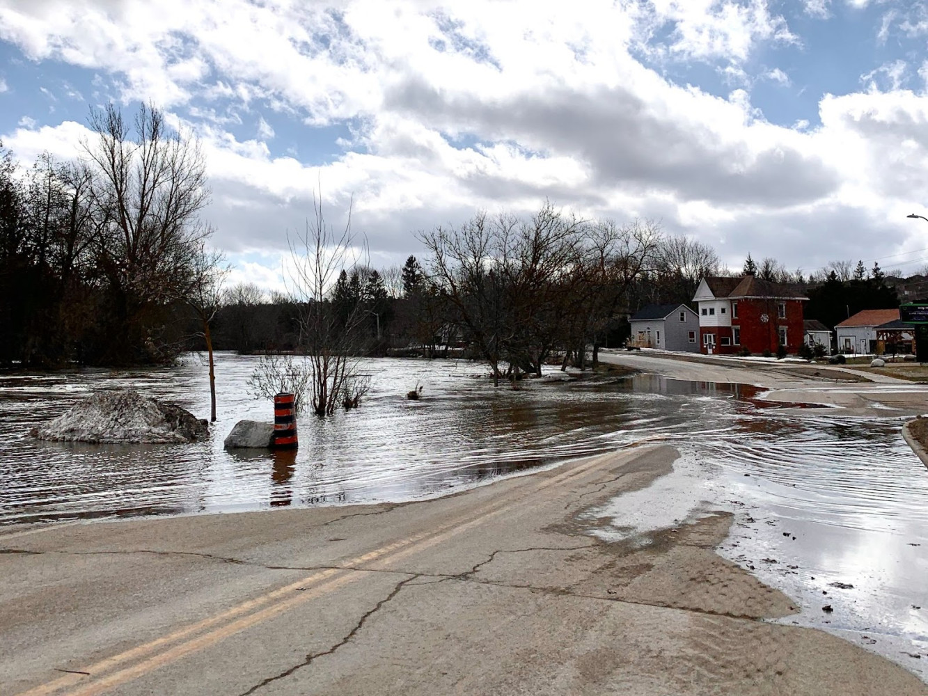
As climate change increases the amount of precipitation received by GTA municipalities, flooding will become more common, particularly in low-lying areas and floodplains.
(Alexis Wright/The Pointer files)
In the event that no intervention is given, as was the case with Churchville, there are a few ways that an ice jam can unfold: ice jams can break up themselves or break up when a large influx of water comes from upstream, they can be grounded, or they can melt away with increasing water and air temperatures. The ice jam on the Credit River dislodged on February 23, 2022, six days after it first occurred.
The most recent flood in Churchville has also brought into question the state of the community’s flood infrastructure. The staff report notes that two of the City’s storm sewer outfalls failed, allowing for the flooding to back up to the roads and properties behind the existing berms. City staff and external contractors concluded that these failures occurred due to jammed flap gates which have since been repaired by the City.
The City is also conducting a structural assessment and a municipal class environmental assessment (MECA) to evaluate the current flood infrastructure and try to identify methods for mitigating long term flood risk. An assessment of the existing floodwalls and berms will be undertaken by independent contractors in the third quarter of this year. Since 40 percent of the existing berms are located on private property, City staff have contacted property owners for permission to enter their properties for the purpose of the study.
The City will undertake the MECA in collaboration with the Province and the CVC along with engagement from residents. It will determine what meaningful solutions are available to help mitigate flood risk in Churchill. However, these solutions could provide difficult budget questions for the City and CVC once identified.
A recent report from the Toronto and Region Conservation Authority determined it does not have sufficient funding to update all of its flood management infrastructure in need of repair. The report concluded that without significant investment from the Province, much of the lower-risk repairs would go uncompleted.
The CVC told The Pointer the conservation authority owns one lot in the community associated with the original berm construction, but it is leased to the City of Brampton for management. The spokesperson also noted that neither the CVC nor the City of Brampton has easements to update the berms located on private property.
What these future solutions can not change is the physical geography of Churchville sitting in a low-lying floodplain. Previous policies allowed for development within the floodplain, leading to the development of approximately 50 buildings at serious risk of flooding—now perhaps more so due to climate change increasing the threat of damaging floods.
While the City of Brampton’s report recognizes the shortfalls of building within floodplains, the provincial government is increasingly making it easier to secure these areas for development, putting more homes and people at risk.
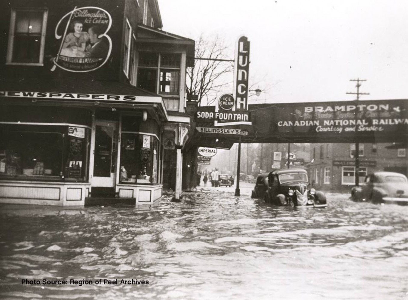
Brampton's downtown also sits in a floodplain creating barriers to development. It was devastated by flooding in 1948.
(Region of Peel Archives)
In its quest to build 1.5 million homes by 2031, the PC government has downgraded the jurisdiction of conservation authorities and made significant changes to the wetland evaluation system (WES). Subsequent legislation made changes to the Greenbelt Act, making it even easier for unchecked development to occur in areas prone to flooding.
The changes to the WES will curve the evaluation to make it more difficult for wetlands to achieve provincially protected status. Any wetland that does not receive this status, can be built upon.
The Bill disqualifies the majority of wetlands in southern Ontario from protection. Currently, when attempting to determine if a wetland deserves protection, these natural features are evaluated on a scale between zero and 1,000. If a wetland scores over 600, it is considered provincially significant and is shielded from development. Bill 23 makes it difficult for points to be accumulated, by removing the ability to count points for things like the presence of endangered or threatened species, leaving many without protection.
The Bill also eliminates the idea of a “wetland complex”. These crucial ecosystems are often grouped, meaning there is a series of small ponds or other bodies of water that are amalgamated in a low lying area. Prior to Bill 23, the scores of these groups would be added together as a wetland complex and if the entire complex scored over 600 it would be protected. Now, each pond or wetland, regardless of how small, will be analyzed separately, effectively eliminating the concept of a wetland complex within the regulations, resulting in a large number of small wetlands that provide crucial habitat for wildlife, as well as natural functions that benefit cities, like flood protection and water filtration, from receiving protection, making them vulnerable to development.
Building in and around wetlands not only disturbs the natural carbon sinks and the biodiversity of species that live within them, but it also leaves the development open to major flood risk.
Wetlands not only serve as havens for biodiversity, but are effective carbon sinks and can protect municipalities from flooding.
(Alexis Wright/The Pointer)
According to Conservation Ontario, the body that represents the 36 conservation authorities across the province, the core mandate of these entities is to “undertake watershed-based programs to protect people and property from flooding and other natural hazards, and to conserve natural resources for economic, social and environmental benefits”.
Under Bill 23, conservation authorities are no longer able to work with municipalities on watershed planning, which includes making sure wetlands and wildlife habitats remain untouched and that people are protected from flooding events.
Since the influence of conservation authorities is limited when it comes to the physical planning, education and outreach has become a very important component of protecting residents from flood risks.
“Flood prevention and recovery awareness and education in addition to evacuation and other emergency response measures will continue to be essential components of a flood risk management and reduction plan for Churchville,” the staff report states.
Even on this most basic front, the provincial government is not doing its part to help. In March, MPP Mary Margaret McMahon, the Liberal critic for Environment, Conservation and Parks, tabled a Bill to help prepare residents of Ontario for the ever-increasing threat of flooding.
“Flooding is the number one cause of public emergency in Ontario. It’s the number one natural disaster in Canada. It’s costing Canadians more than any other climate issue,” she said in a press conference before the Bill went to second reading.
The intentions of the legislation were threefold: to establish the last week in March as Flooding Awareness Week, symbolic of the warming temperatures that can cause dramatic melts; to improve the Government of Ontario website to provide stronger resources on flood risk and mitigation measures; and to provide Ontario residents with an infographic on a variety of steps that can be taken to prevent basement flooding.
Despite her best intentions, McMahon’s Bill was voted down by the PC majority at Queen’s Park 64 to 33 after second reading.
The City of Brampton estimates that the funds needed for the studies related to the Churchville flood will cost the City $345,000. The money already exists within current capital project funds.
Email: [email protected]
Twitter: @rachelnadia_
At a time when vital public information is needed by everyone, The Pointer has taken down our paywall on all stories relating to the pandemic and those of public interest to ensure every resident of Brampton and Mississauga has access to the facts. For those who are able, we encourage you to consider a subscription. This will help us report on important public interest issues the community needs to know about now more than ever. You can register for a 30-day free trial HERE. Thereafter, The Pointer will charge $10 a month and you can cancel any time right on the website. Thank you
Submit a correction about this story
