
Southern Ontario, once home to a thriving monarch butterfly population, is the flagship of habitat fragmentation; the GTA West Highway will only make it worse
On a clear August morning, ecologist Ryan Norris wades through the knee-deep grass of the Nashville Conservation Reserve searching for pupae of the monarch butterfly.
Monarchs perform one of the most wondrous and mystifying feats in the natural world.
Their annual migratory flight is nothing short of miraculous and lepidopterists are still unclear exactly how the phenomenon is performed by these silky beautiful genetically programmed creatures.
The annual 8,000 kilometre journey is done by multiple generations of monarchs; the same butterfly that begins the epic flight is not the one that ends it, somehow finding its way back to the exact mountain top its ancestor left months earlier, thousands of kilometres away.
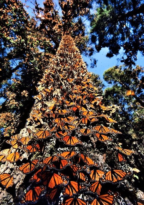
An oyamel fir tree in Mexico is covered with thousands of monarchs that have just emerged from their chrysalis after overwintering before setting out for their epic journey to the U.S. and Canada. Four generations of the same butterfly will complete the annual migration. (Image-Pintrest)
Each fall tens of millions of monarchs begin their poetic journey from the midwestern and northern U.S. and across southern Canada to the various overwintering sites in Cuba, California and the Sierra Nevada mountains outside Mexico City.
It might seem elegantly simple to scientists who have determined some of the monarch’s incredible navigation system, using their antennae as a compass, the sun’s ultraviolet light as an evolutionary guide and an internal magnetic system to lead them on their exacting journey. To laypeople, it’s nothing short of magical.
Somehow, a monarch that takes flight from an oyamel fir tree towering at the perfect temperature point near a mountaintop in Mexico, after emerging from the chrysalis that entombed it for weeks, passes its genetic imprint to the next generation of butterfly and the next and the next, which completes the annual life cycle before returning to the exact spot thousands of kilometres away, from where its ancestor took flight.
Predators, storms that blow them off course and other dangerous obstacles have not been able to do what humans have in a few short decades.
Because of the destruction of monarch habitat across North America, specifically the milkweed they depend on for food, numbers have plummeted. The continent’s monarch population has gone from almost a billion adults in the ‘90s to about 35 million in 2016. The loss of other plants that offer nectar is another reason for the alarming decline in monarch numbers.
These beautiful creatures have survived on Earth for more than 50 million years, and in just a few decades humans have managed to put them near the brink of extinction.
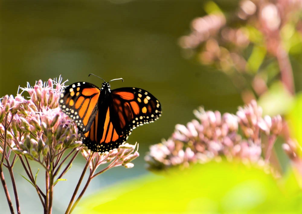
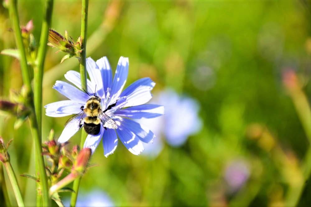
The delicate insects with their distinctive orange wings lined with veins of black, lay their eggs exclusively on milkweed plants. Monarch caterpillars are one of the few species who can tolerate the plant’s poisonous sap and females can place up to 400 sticky beads of future life on the underside of milkweed leaves in a matter of weeks during the summer season.
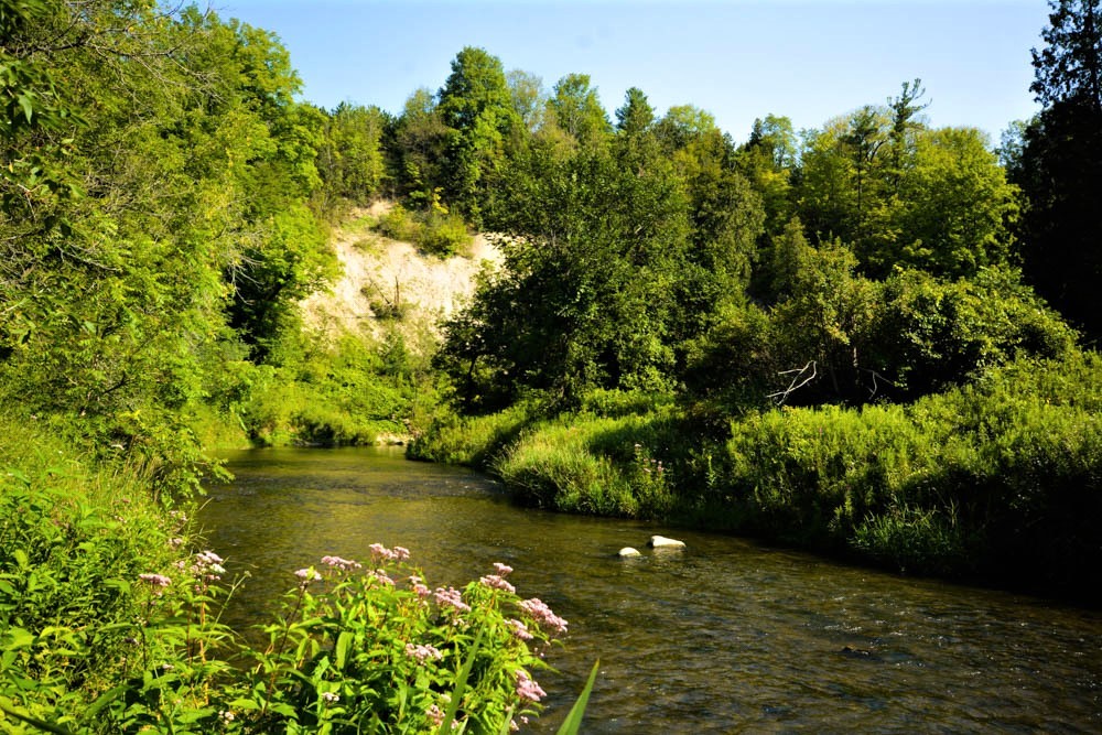
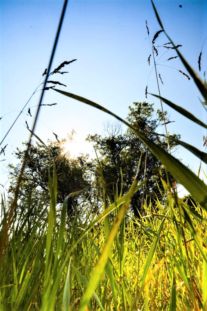
The Nashville Reserve, just north of Toronto in York Region, with its 900 hectares of protected green space, and open fields of meadow grass and wildflowers, should be a perfect location for the near-endangered species.
But on this day, Norris turns up empty handed.
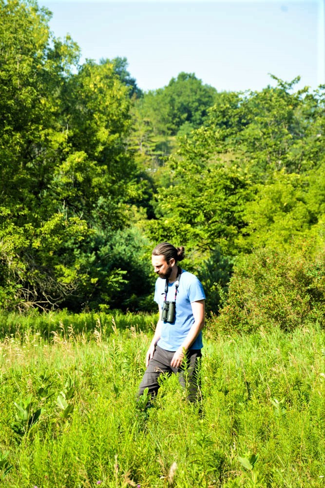
Ryan Norris, a professor at the University of Guelph, searches for signs of the monarch at the Nashville Conservation Reserve. (Photo by Joel Wittnebel/The Pointer)
Birds cut patterns through the blue sky above, spiders, toads, ticks and beetles crawl underfoot. The green space that thousands of species call home, some of them threatened or endangered, is labelled an “integral” part of the natural heritage system that straddles the border of York and Peel regions.
“The Nashville Resource Management Tract boasts extensive, high quality habitat that supports a diverse suite of species. It is valued by community members and visitors alike for its unique cultural heritage resources, spectacular trails, and agricultural features,” the Toronto Region Conservation Authority’s (TRCA) vision statement for the area reads.
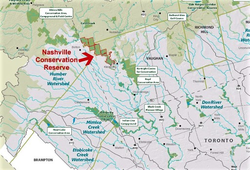
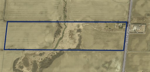
The Nashville Conservation Reserve will be cut in half by the GTA West Highway. (Map from the TRCA).
The value placed on the land is not enough to protect it from the pressures of urbanization. The decline of the Monarch is not the only telling sign that things are changing at the Nashville Conservation Reserve, as the oasis of natural life lies in the path of the GTA West Corridor. The resurrected plan for a new 400-series highway connecting Milton and Vaughn through Caledon and the western side of Brampton, threatens to pave long stretches of blacktop over this swath of protected land.
“You chip, chip, chip and each little cut is another blow to biodiversity. It has to stop,” Norris says. “The development of the highway is more than just what it cuts through.”
According to the TRCA, over 1,000 hectares of land identified as important for local wildlife movement will either be completely removed or intersected by the proposed highway. The mega transportation route will also destroy 75 wetlands, 28 of which are designated as provincially significant. Ontario Nature says 20 percent of the province’s species at risk are directly dependent on wetland habitat for food, shelter, water and space, but these critical areas are fading fast.

The GTA West Corridor will bisect the Nashville Conservation Reserve (Photo by Joel Wittnebel/The Pointer)
Habitat fragmentation is one of the most prominent threats to wildlife — including the monarch butterfly — across Ontario, and North America, and the GTA West Highway threatens to exacerbate fragmentation in a critical area of Ontario—the Greenbelt.
It is the world’s largest protected ecological space, under threat of encroachment by urban development for decades.
“Southern Ontario is really the flagship of fragmentation,” Norris says. “We can’t continue to lose habitats like this. We rely on these watersheds for our drinking water and there are very few of these habitats left in Southern Ontario.”
Earlier this year, using information from the Province’s Natural Heritage Information Centre, The Pointer was able to determine that 29 species either listed as endangered, threatened or of special concern have been spotted along the highway’s route in the last 6 months, 21 of them inside the areas where proposed interchanges could be built, transforming valuable habitat into a hub of automobile traffic and human activity.
This includes six species listed as endangered, seven as threatened, and eight species of concern. In many cases, the species are named on both provincial and federal government at-risk species lists, meaning their habitat is usually protected under government legislation. While species of concern don’t receive such protection, they are closely monitored due to their vulnerability to potentially becoming threatened or endangered.
Many of the species, The Pointer found, were spotted in the area of multiple interchanges, meaning the impact on them could be even more severe as the highway would destroy multiple habitats they rely on in one fell swoop.
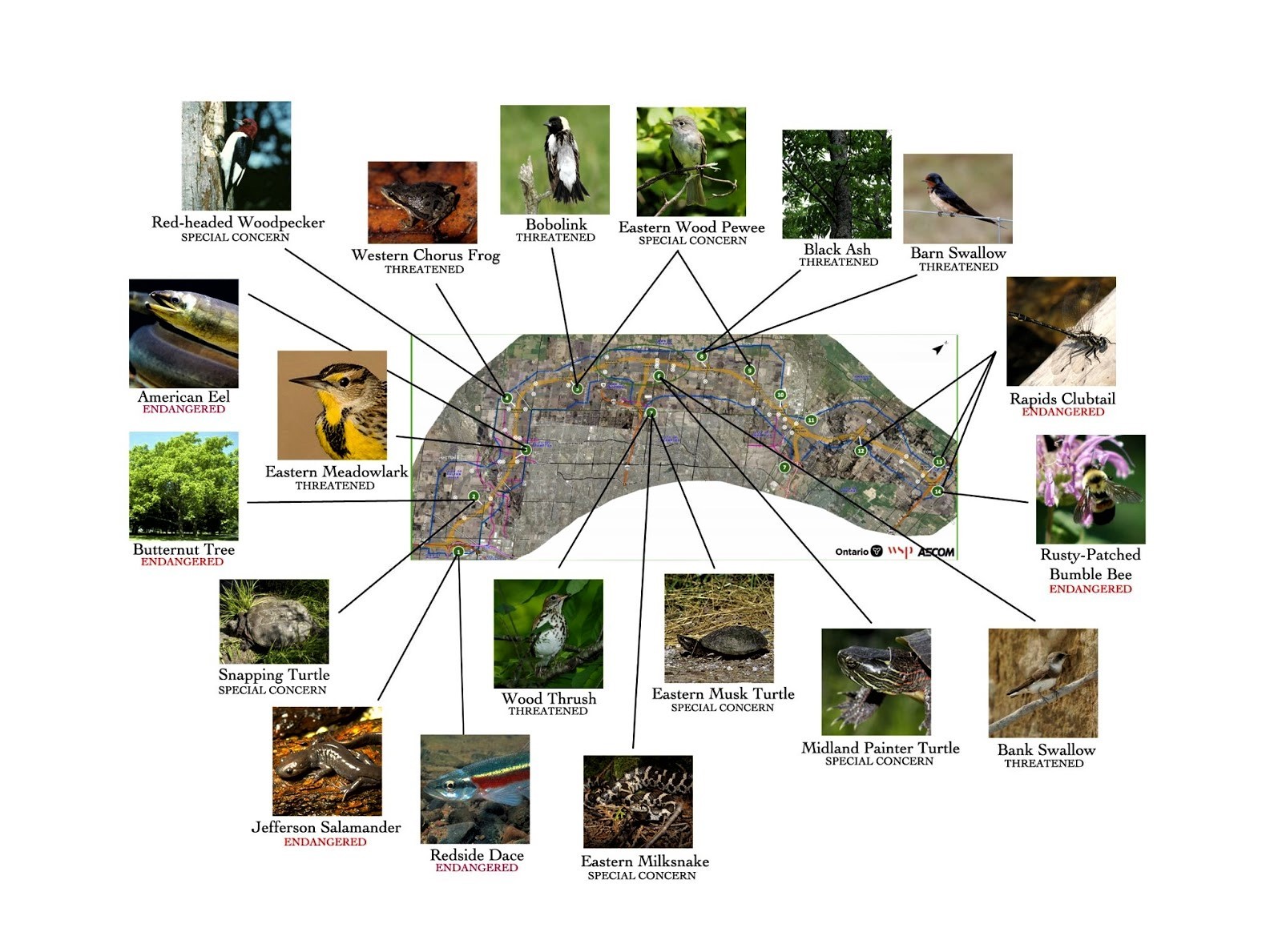
Close to 30 species at risk will be impacted by the GTA West Highway. (Graphic from The Pointer)
The bobolink and the eastern meadowlark, both threatened species, have been spotted in all but one of the 14 interchange locations for the proposed GTA West Highway. The endangered butternut tree grows in 6 of the 14 interchange locations. The endangered rapids clubtail dragonfly has been spotted in 3 of the 14, and the redside dace, also endangered, has been seen swimming in the waterways running through 11 of the 14. Many of the same species rely on the Nashville Conservation Reserve for breeding, feeding and life-sustaining habitat and have been spotted there in the last six months.
As cities grow, roadways extend into previously unused space, dividing meadows, farmer's fields, and forests with strips of pavement. Houses are built on land previously home to all manner of tiny creatures, and migratory bird pathways are completely altered, eliminating resting grounds and food sources for birds that rely on these locations to complete their migration cycle.
The cumulative impact of increasing urbanization is something that has not been studied, so quantifying the number of animals impacted and how badly, is next to impossible. But it is known that loss of habitat and fragmentation is one of the leading causes of the decline in species across Ontario, Canada and the world. For example, birds that rely on grassland and agricultural habitats in Southern Ontario are showing steep population declines as a result of these habitats disappearing beneath the developer's bulldozer.
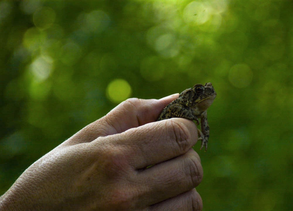
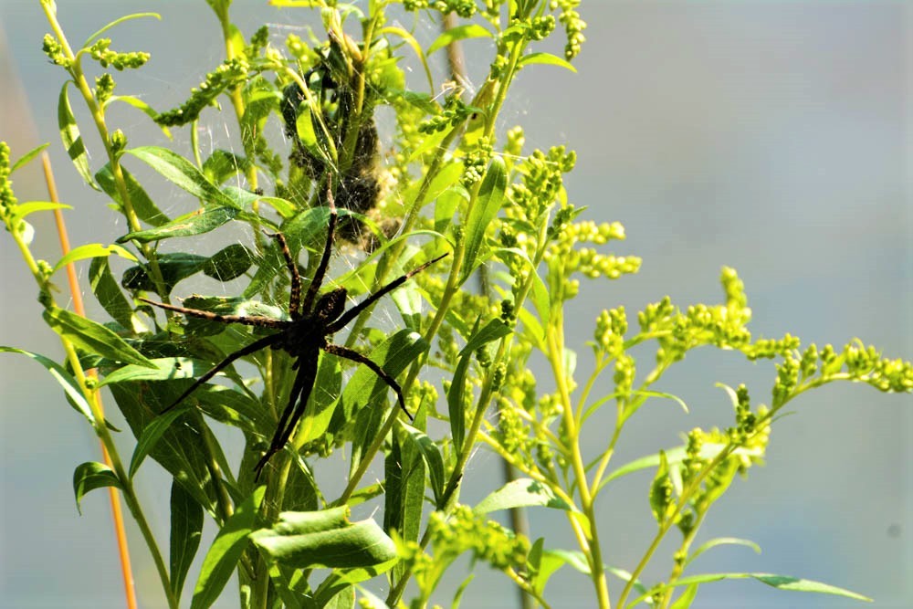
An abundance of life at the Nashville Conservation Reserve (Photos by Joel Wittnebel/The Pointer)
The damage doesn’t end there. Along with the direct habitat loss, these new urban areas create a large number of stresses to the habitats that border them, and runoff of contaminants from roadways and industrial uses find their way into local waterways, placing extreme stress on the fish and other aquatic life that rely on pristine water to feed and reproduce.
“You can’t get away, no matter what you do, from having some sort of impact on the aquatic and terrestrial environment,” Norris says.
Examples of this decades-long dissection of Peel’s natural environment are everywhere. In Brampton, a proposal presented at the September 13 planning and development committee meeting looks to erect 94 single detached dwellings and 27 streetfront townhouses on either side of a vital wildlife corridor.
From green space to subdivision: Every new development decision is another habitat fragmented by urbanization. (Images from City of Brampton)
At the same meeting, the Gore Meadows Secondary Plan was considered that will see more open space converted into subdivisions. To the City’s credit, the land designation has been changed from “estate residential” to “residential” meaning more dense housing will be placed on the land.
In Caledon, a number of proposals are currently threatening existing farmland and woodlots. A pair of proposals along Dixie Road combine for approximately 4.9 million square feet of “e-commerce development” including warehousing, distribution and industrial uses. In both applications, agricultural land will be lost and sections of the Greenbelt will become surrounded by pavement; pavement that will carry GHG spewing, diesel leaking semi trucks. According to the NHIC two threatened species — the bobolink and eastern meadowlark — have been spotted in the area of the 12862 Dixie Road site, along with the woodthrush and eastern milksnake, both species of special concern. The bobolink and eastern meadowlark have also been spotted on the 12035 Dixie Road location and the redside dace, an endangered fish, has been seen in the waterway that runs through it. The cumulative impact on all of these species, many of which also lay in the path of the GTA West Highway, is immense.
In Caledon, the problem is much bigger than these two applications. At the start of June 2021, there were 30 development applications across the town’s five wards proposing to convert approximately 1,066 hectares — about 2,000 football fields — of prime agricultural land. “Approving this application will be yet another instance of degrading an ecosystem, in this case the Greenbelt, and flies in the face of the Region of Peel’s declared climate emergency as well as conflicting with key statements of the Town of Caledon’s Agriculture Policy,” said Caledon resident Jenni LeForestier during a Caledon council meeting earlier this year.
Fragmentation is unavoidable. In Peel, where the region is expected to grow to close to 2 million people by 2041, the region will need to build homes to accommodate this influx. This means that in order to prevent ecosystem collapse and mitigate climate change, a balance must be struck between urban expansion and preserving the natural world that neighbours our cities.
The GTA West Highway has been opposed by almost all of the municipalities along its proposed route, including the Region of Peel, the City of Mississauga (the City of Brampton has remained ambiguous with its stance, pushing the Province to construct an unrealistic “boulevard” through Brampton’s section of the 400-series highway). The provincial Liberals and NDP have vowed to scrap the project. The tremendous pushback, fuelled by local environmentalists and other grassroots movements, led the federal government to designate the project under its federal environmental impact assessment process. This means the feds are currently seeking further information from the PC government on how it plans to mitigate the impact to species at risk, among other things, before the project moves ahead. There is no guarantee the federal government will cancel the project.
Norris says the designation of the project is essential in order to properly study the highway impacts on the Greenbelt and places like the Nashville Conservation Reserve, something the province has not guaranteed it will do as it sought to have the project exempt from certain elements of the environmental assessment process. He wrote a letter, signed by 50 other biologists, scientists and environmental professors, urging the federal government to conduct its own environmental assessment. He says many of his colleagues were eager to sign the letter.
“It was extremely easy to get those 50 signatures. Every single academic I contacted signed that letter,” he says. “I think it’s clear when you look at the facts of where it’s going, its utility in the larger transportation scheme of things, and the impact it will have on a number of species in the watershed that I don’t think biologists have to think too long about it.”
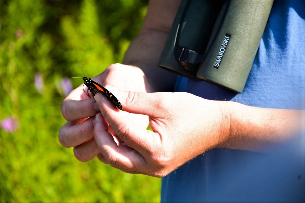
Ryan Norris gently handles a monarch butterfly at the Nashville Conservation Reserve. The species is listed as one of special concern in Ontario, but many experts say it should be classified as endangered as a result of its rapidly declining numbers. (Photo by Joel Wittnebel/The Pointer)
Mitigating the impacts of habitat fragmentation and loss is also critical in the battle against climate change, something that was front of mind throughout the summer election campaign. The natural world will be a key ally in our fight to reduce CO2 emissions, and protecting places like the Nashville Conservation Reserve is a perfect place to start. The land was first purchased in the 1960s with plans to build large reservoirs to protect against flooding. However, when funds never materialized to construct the reservoirs, the land was left as is, and has been protected by the TRCA ever since. The conservation authority has made investments to protect and restore the habitat, including tree planting, wetland and shoreline restoration projects inside the reserve and habitat restoration, like providing nest boxes for tree swallows, barn swallows, eastern blue birds, and black-capped chickadees as well as providing platforms for grebes to nest.
Continuing to leave such spaces in their natural state is one of the key ways to help mitigate emissions and reduce the impacts of climate change.
A recent study from Nature United identified 24 “pathways” which if fully implemented can help Canada reduce its natural GHG emissions by 11 percent — or 76 megatonnes — by 2030, or the amount equal to powering every single home in Canada for three years.
The study identified a trio of different project types — protect, manage, and restore — of which management efforts, projects like those that improve the health of existing forests, or agricultural efforts like planting cover crops to keep soil healthy, have the potential to reduce 57 percent of the total GHG emissions identified. Protection efforts, or simply leaving our green and agricultural spaces alone, can reduce Canada’s emissions by 30 megatonnes of carbon by 2030. Only 5 percent of the GHG emission reductions identified come from restoration efforts like tree planting programs or wetland restorations. It means that while municipalities celebrate successful tree planting programs, any mitigating impact those trees have on the climate picture is completely erased by making poor land use decisions that compromise Greenbelt lands or destroy prime agricultural land.
“Trees are great and they are really an important way to think about nature based climate mitigation, but in terms of creating new forest, we really need to give those forests time to grow and make sure we are stewarding them in the long term,” says Ronnie Drever, Nature United’s senior conservation scientist and lead author of the study. “A lot of the opportunity is really cost effective and certainly a lot cheaper than other types of mitigation approaches. So, I think that there is definitely a role for this type of information in helping people making decisions like that and valuing our existing system and making sure we work harder to restore our degraded ones.”
Drever says the biggest opportunity identified in Ontario is the protection of existing grasslands — which includes pasture lands, hay lands and native prairie.
Protecting grasslands will be critical in our fight against climate change. (Photo by Joel Wittnebel/The Pointer)
If poor growth decisions continue to be made by local municipalities, paving over critical green space, it will not just impact those local areas, but can have a domino effect across all of Peel’s climate change mitigation efforts.
The beautiful monarchs, which colour so many of our childhood memories, would be among the losses felt due to human activity.
To slow the trend, if Peel is unable to reach its climate change goals, that could prevent the broader GTA from reaching its targets, then the province, then the country.
And, of course, the entire world.
Email: [email protected]
Twitter @JoeljWittnebel
COVID-19 is impacting all Canadians. At a time when vital public information is needed by everyone, The Pointer has taken down our paywall on all stories relating to the pandemic and those of public interest to ensure every resident of Brampton and Mississauga has access to the facts. For those who are able, we encourage you to consider a subscription. This will help us report on important public interest issues the community needs to know about now more than ever. You can register for a 30-day free trial HERE. Thereafter, The Pointer will charge $10 a month and you can cancel any time right on the website. Thank you
Submit a correction about this story
